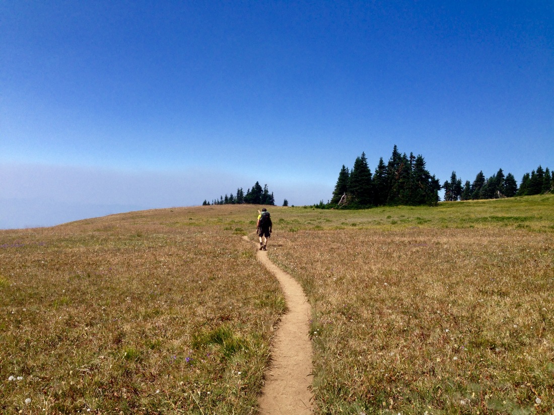
I had assumed I’d be traveling solo for the bulk of my adventures this past summer, so I was pretty psyched when my friend John expressed interest in joining me on the section of the Pacific Northwest Trail that traverses Olympic National Park. After I completed the North Cascades section, John and I met up at The Happy House to prepare, then set out on our epic journey. Most seasoned hikers take about two weeks to complete the 200+ miles, but we were complete overachievers and did it in three, ensuring that lazy mornings and swimming were priorities. The miles we walked took us from Coupeville, WA to Shi Shi Beach…but with a twist. I’m not ashamed to say that we planned our trip around avoiding hiking a 6,000 foot elevation gain up Hurricane Ridge, also providing ourselves with an additional food resupply in an otherwise long section. In a nutshell, we started at the top of Hurricane Ridge and hiked westbound to Shi Shi Beach, then returned to Hurricane Ridge and hiked eastbound back to Coupeville. Hike smarter, not harder.
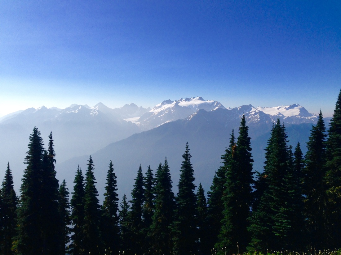
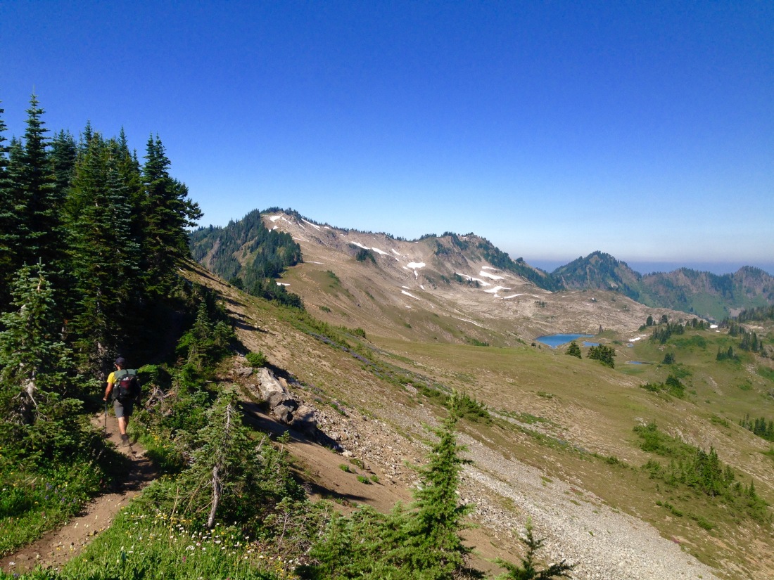
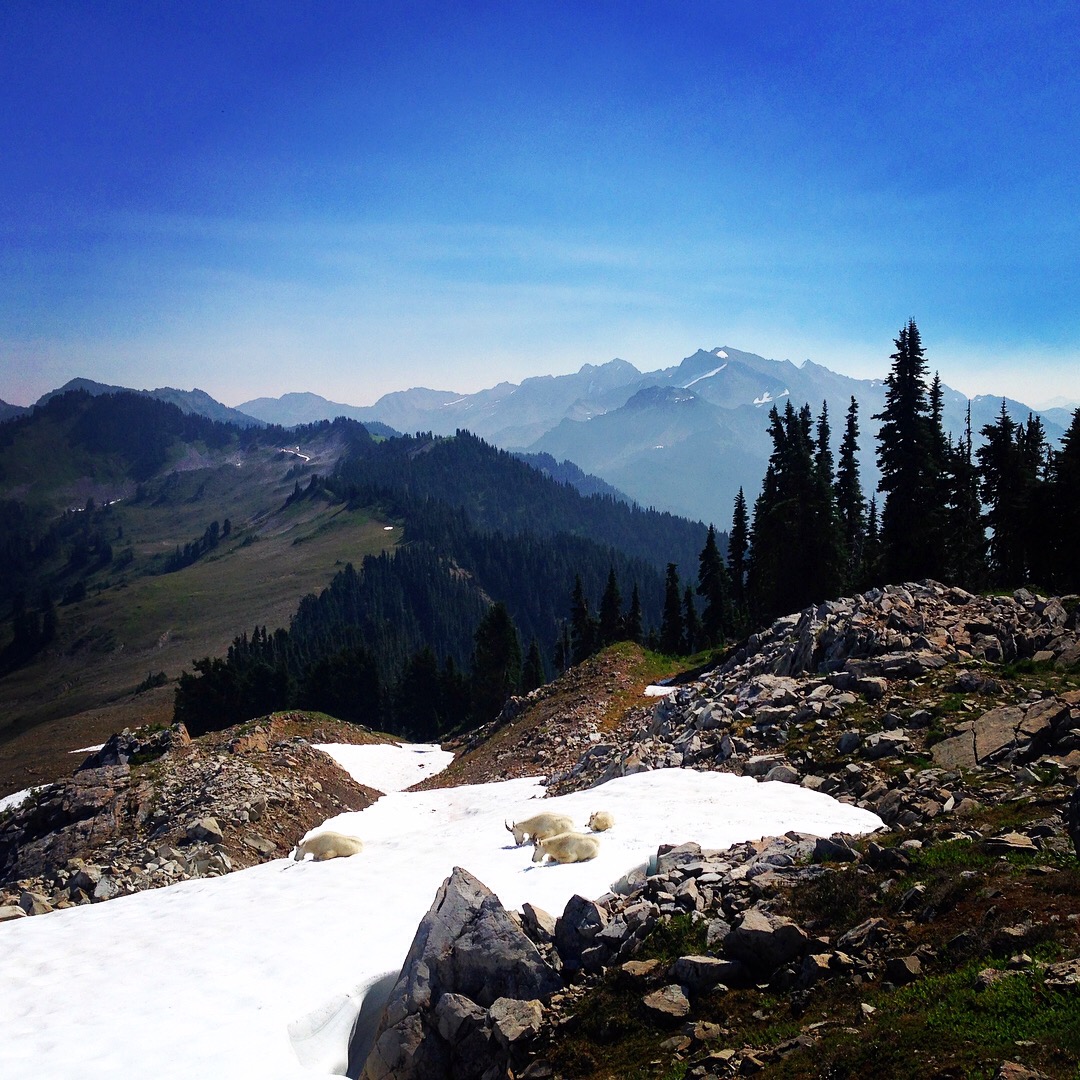
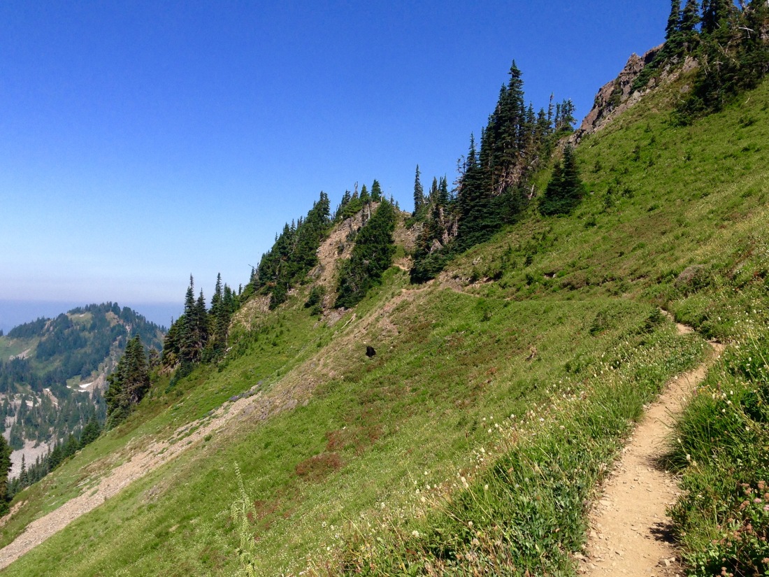
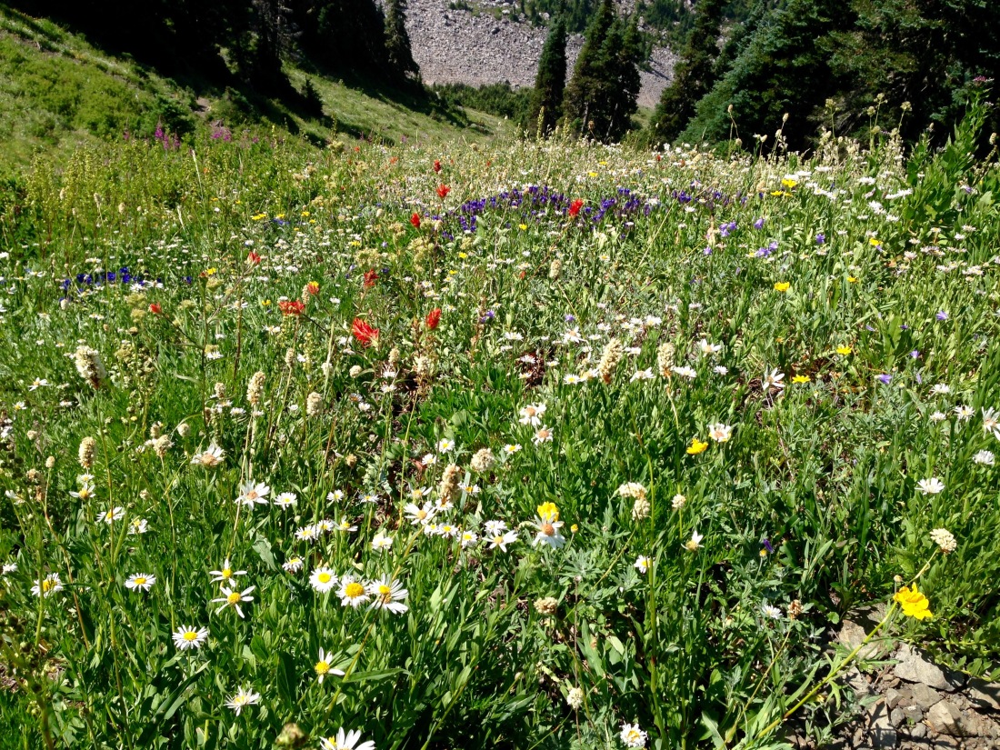
When we started out at Hurricane Ridge, our views were somewhat obscured by the wildfire smoke that had poured into the area from the fires burning in British Columbia. We could make out Mount Olympus to the south, but the ocean views were completely non-existent. We hiked down from Hurricane Hill into the Elwha River Valley and then up to the Seven Lakes Basin. The basin was a truly spectacular alpine area, above treeline and with many swimmable lakes. We saw several mountain goats lounging on a lingering snow patch and also a bear feasting on some just-ripe blueberries. Wildflowers were in bloom, and the smoke slowly dissipated as we hiked through the basin and down into the Bogachiel River Valley.


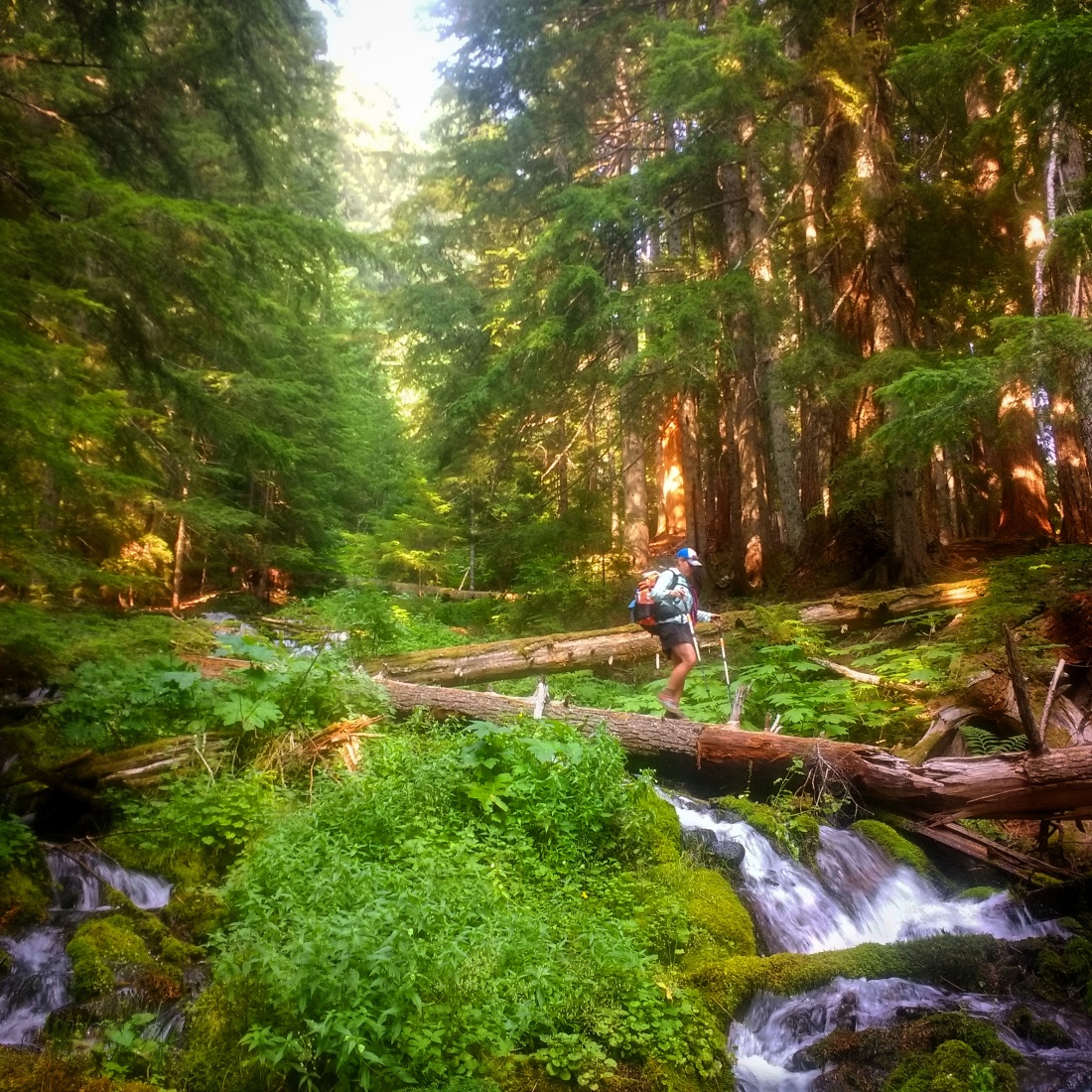
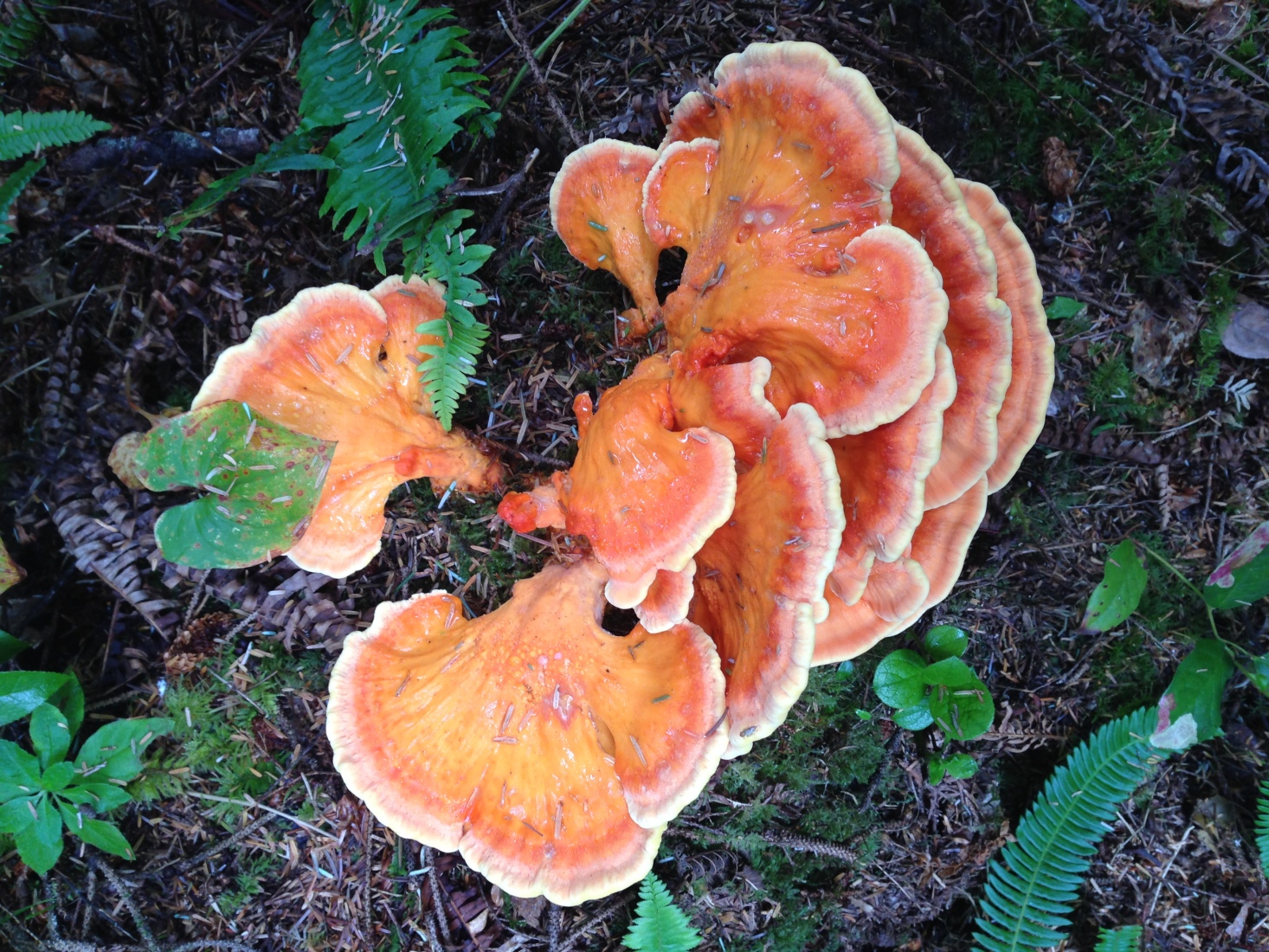
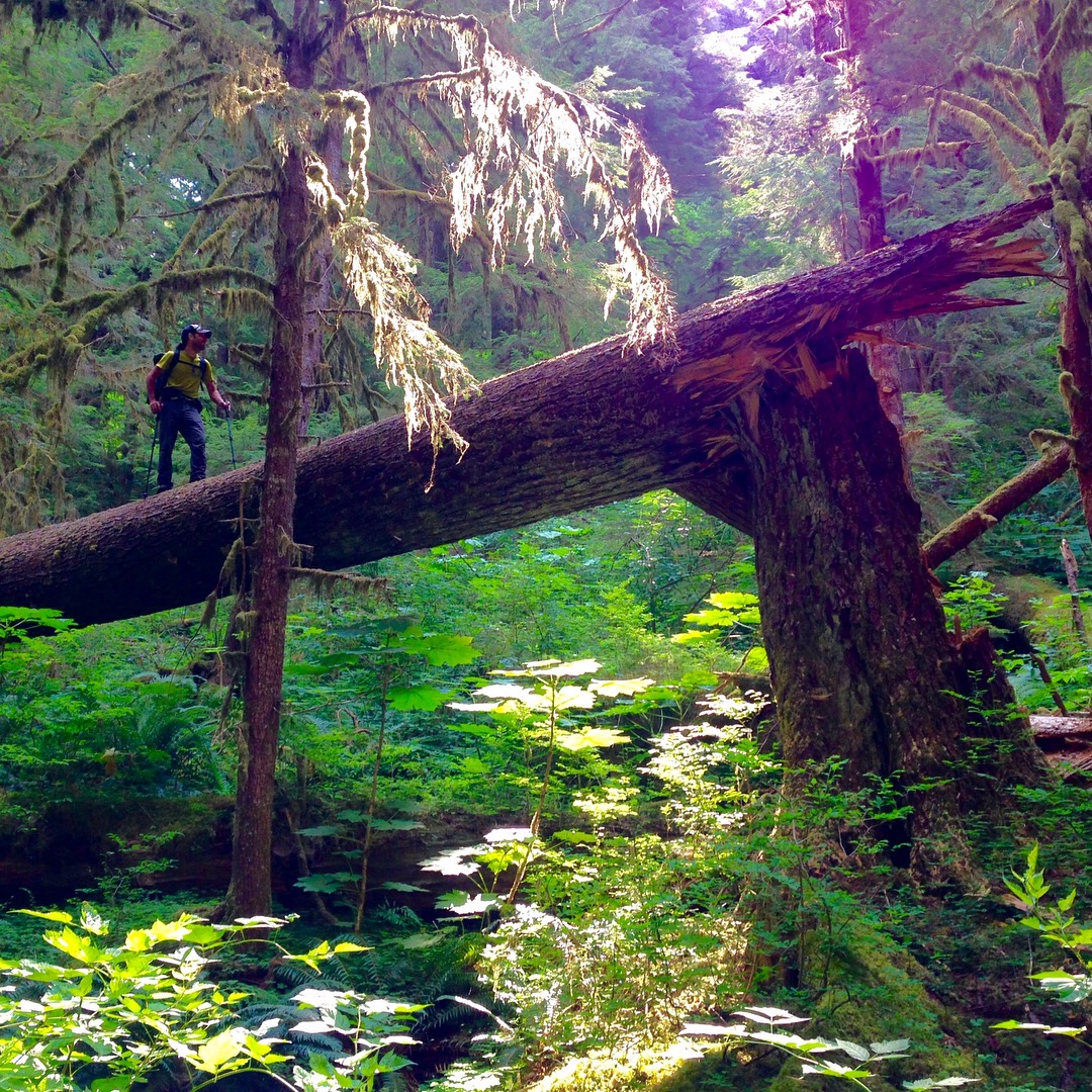
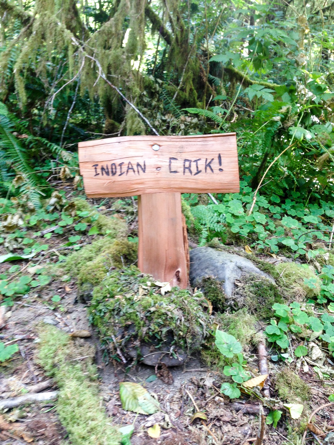
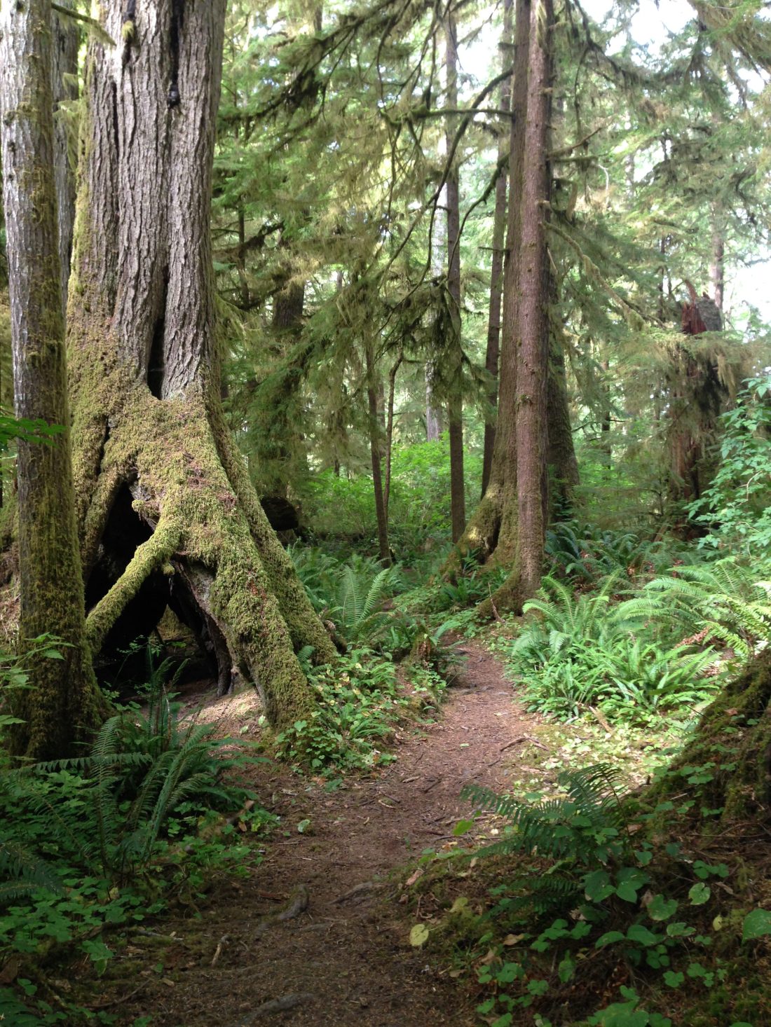
The Bogachiel River originates from several headwater sources in the Olympic Wilderness and flows west, joining with other rivers north of the Hoh, finally pouring into the Pacific Ocean near LaPush, WA. It is part of the Hoh Rainforest, a lush area that sees over 200” of rainfall per year. Luckily, none of that fell while we were hiking. The river boasts some amazing swimming holes, and although it was a fair bit colder than the high alpine lakes we had just left, that didn’t stop us from jumping (ok, easing) in for a refreshing dip. The rainforest is green and lush, with a thick groundcover of ferns and other bushes (many with thorns,) and massive old growth cedar and spruce trees. The way the sunlight filters through the tall canopy gives one the ethereal feeling of walking through a fairy tale.


- Photo credit: John Fontanilles
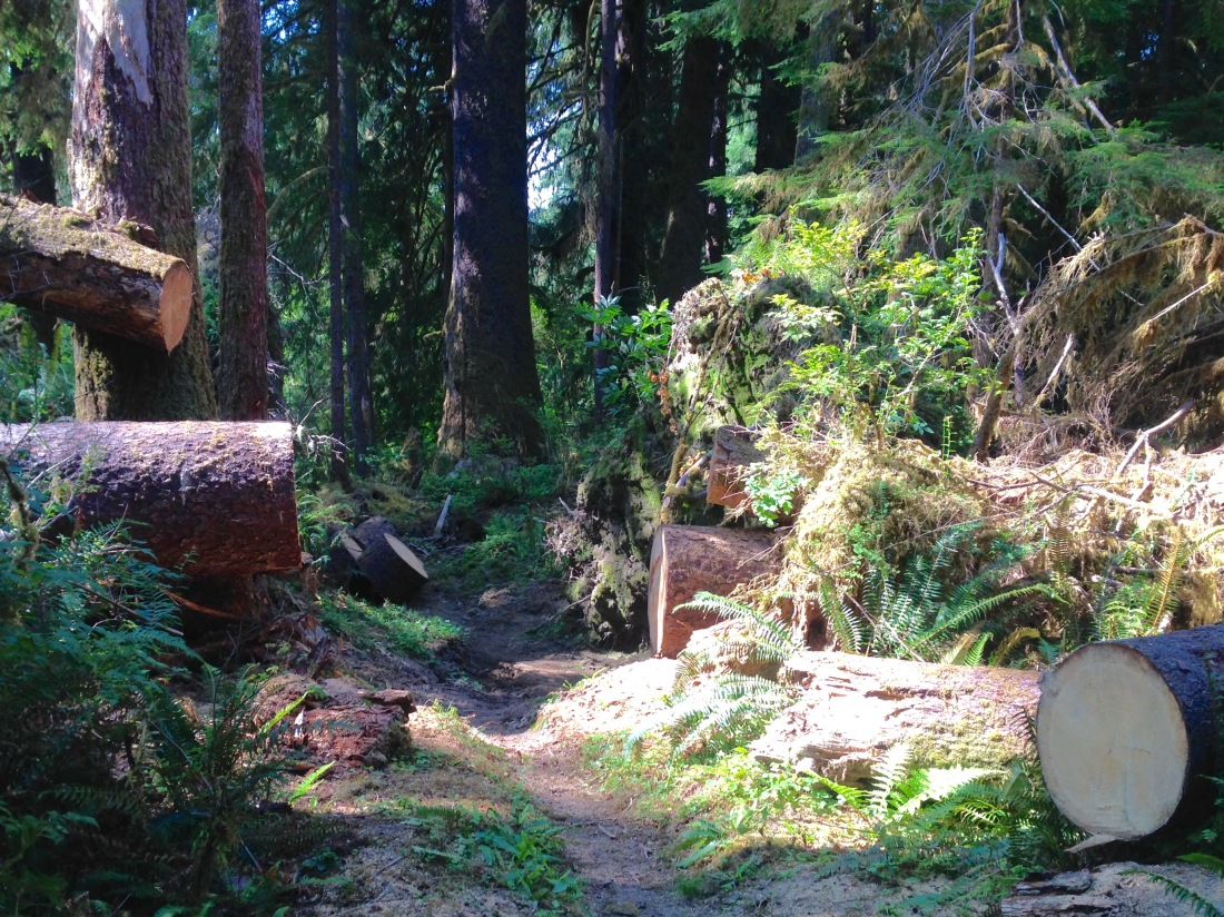
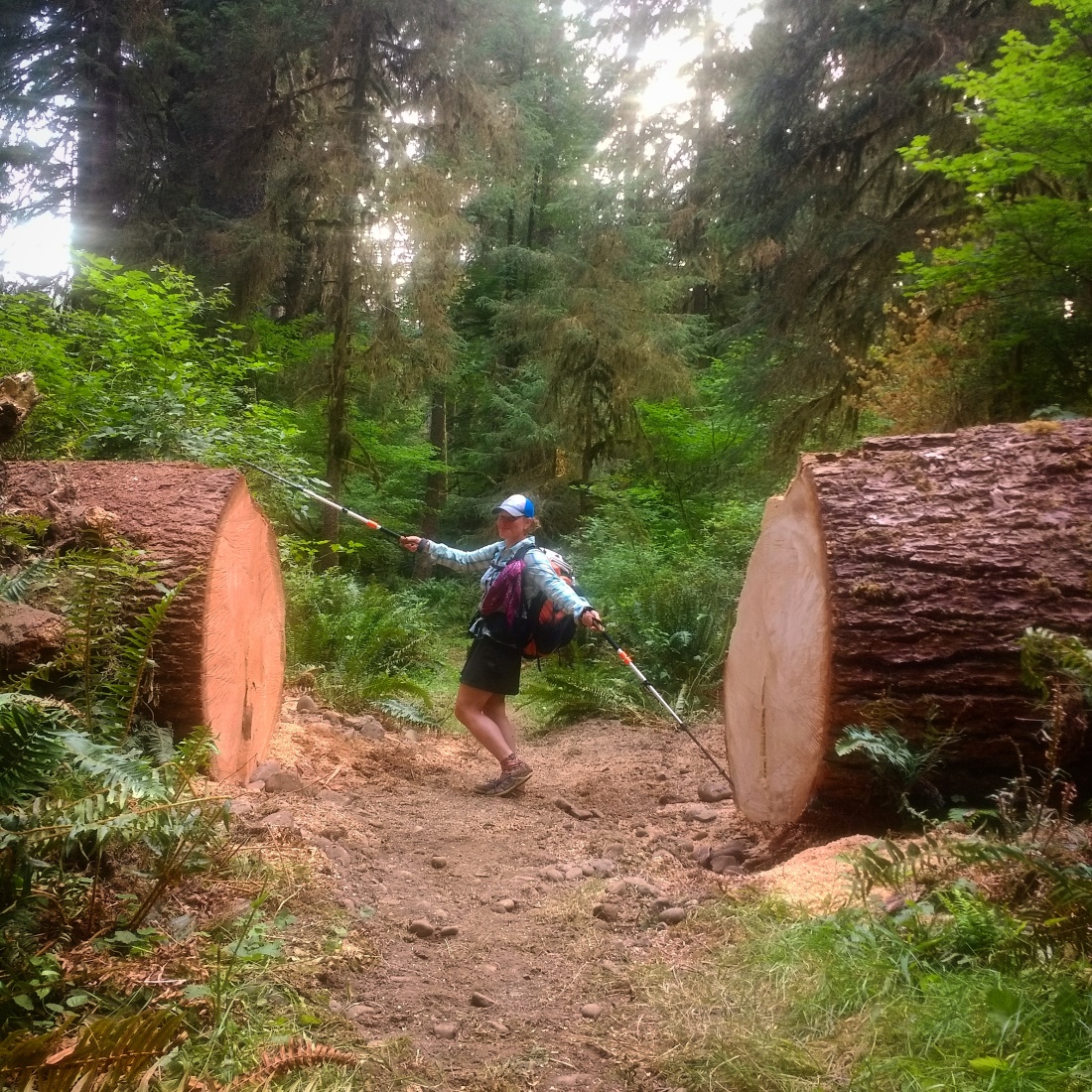
Several miles of the Bogachiel River Trail were impacted by severe winds in 2015 which blew down many old growth trees and obscured the path. Climbing over 5’-8’ diameter tree trunks piled on top of each other for several miles isn’t exactly a fun way to spend time, so we were thrilled to find that a trail crew had begun clearing the trail and most of the blowdowns were cleared by the time we reached them. As with all travel, it’s not just the sights one sees, but the interactions with other people that truly enrich the experience. We were lucky enough to meet the trail crew leader, who had been working in ONP since the late 80’s and gave us quite the history lesson on the area logging operations and trail development. We were enthralled with his description of working with the huge trees, and pleased to be able to thank him personally for his current work on the trail.


Exiting the Park for a spell, we headed to Forks, WA for our food resupply. Displayed in the downtown area is a massive cedar tree round – one of the extra-large trees that was felled prior to when conservation efforts kicked in – where a local man gave us his first-hand account of the “bikers vs loggers” barfight that made national news in 1976. The next day as we were packing up our food outside the grocery store another local gent gave us a very different first-hand account of the same fight. I imagine the real story is somewhere in the middle, but either way it sounded pretty chaotic.
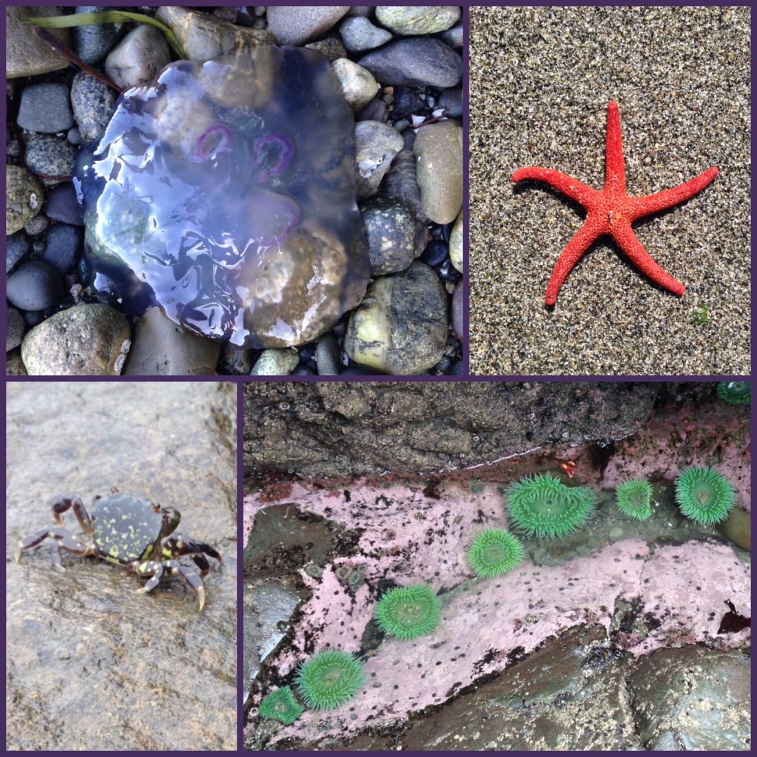
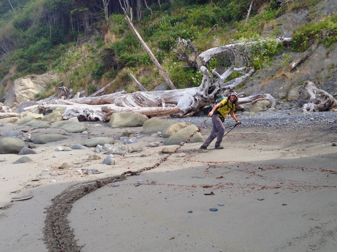
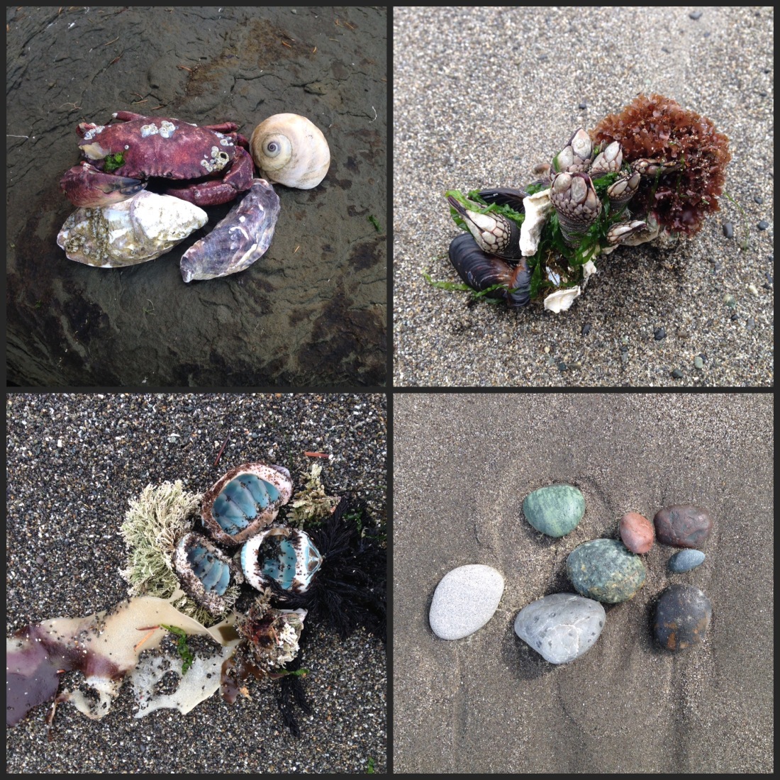
We next headed down to the mouth of the Hoh River at the Oil City Trailhead on the ONP Wilderness Coast. The next 55 miles were an amazing mix of hiking across rocky headlands, scaling bluffs using ropes placed for just that purpose, and walking on the beach. The beach often sported tricky footing on slippery rocks, but had just enough dense sand to keep one sane. The ocean wildlife was a diverse combination of crabs, sea anemone, and the like. We even spied a sea otter one evening just off the shoreline, multiple raccoons, and the occasional deer down from the bluffs to poke about.

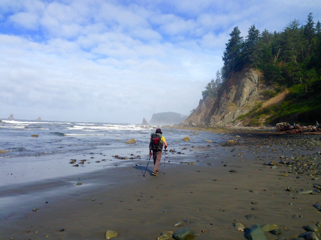
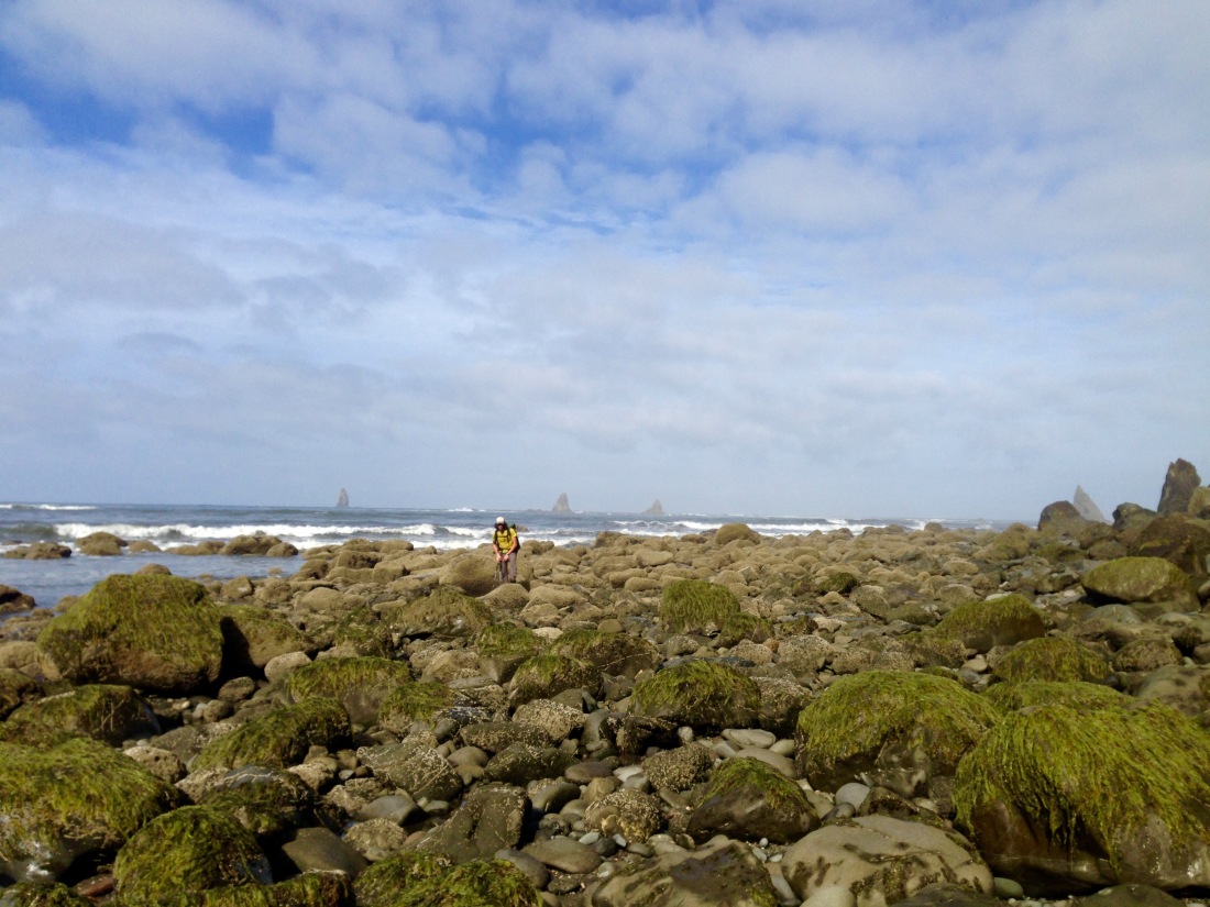
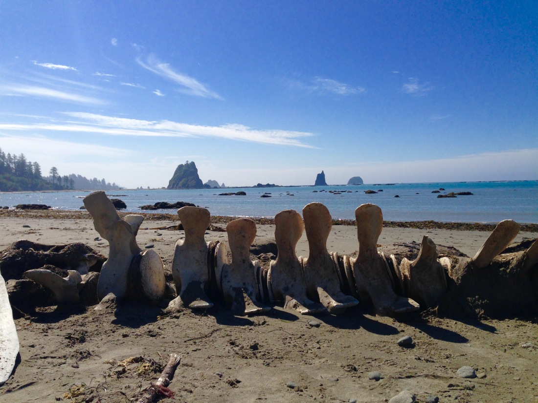


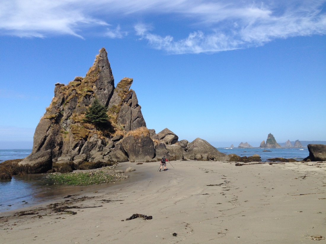
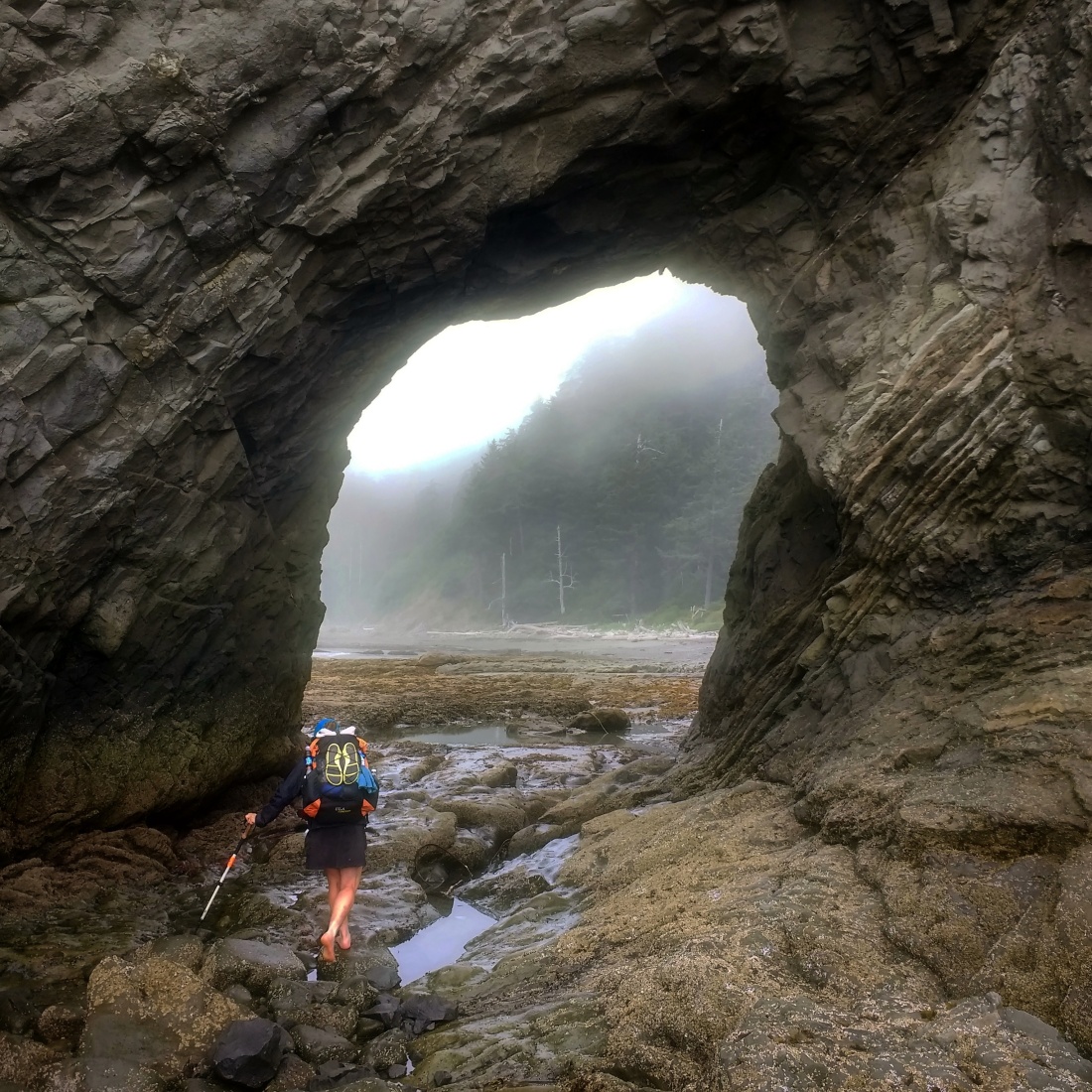
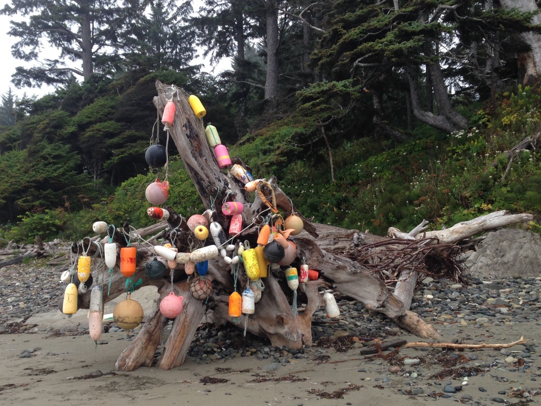
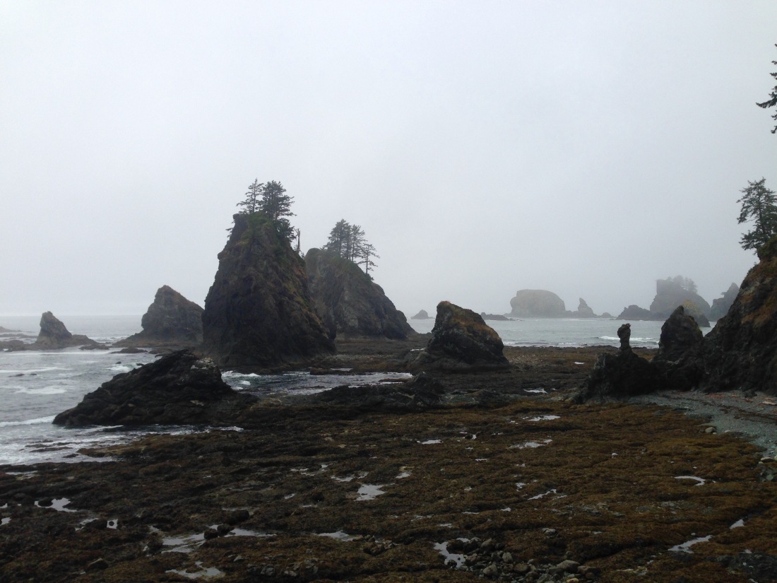
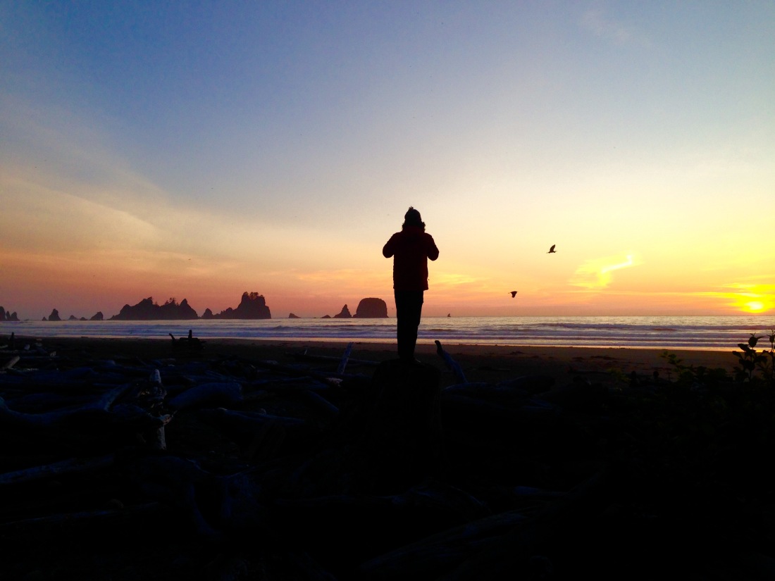
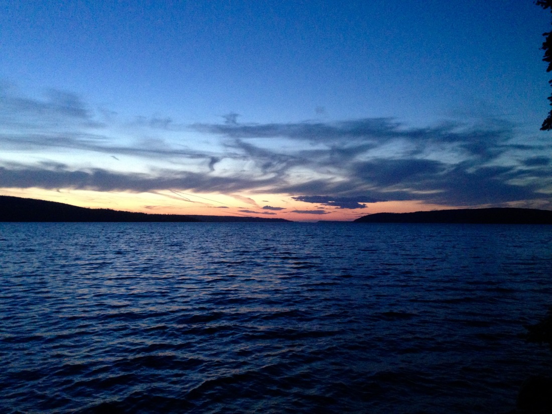
Sea stacks and other interesting rock formations on the headlands lined the coast. One in particular was the aptly named Hole-in-the-Wall, where we timed our day so we could pass through at low tide. The beach was littered with manmade items lost from ships, including buoys large and small. Some were perfect for decoration, and others ripe for drum solos using trekking poles as drumsticks. And then, of course, were the spectacular sunsets, each one with vivid colors, and no two alike.


We trekked past Cape Alava, the official western terminus of the PNT, under overcast skies and dense mist. The next 15 mile stretch was possibly the most challenging of all the beach walking we had done, but finally spilled out onto the wide, dense sand of Shi Shi Beach. We managed to snag a stellar campsite, sheltered from the sea, but with a killer view of one last amazing sunset over the Pacific Ocean.


The beach section was challenging and beautiful, but we were ready for the mountains again. It was time to head back to Hurricane Ridge. Our first ride from Shi Shi Beach to Neah Bay was with a Native American man and local business owner. Amazingly, our second ride – from Neah Bay all the way to Port Angeles – happened to have his nephew as an additional passenger. He entertained and educated us during the long drive with descriptions of some of the local native tribes’ history, culture, and rituals.
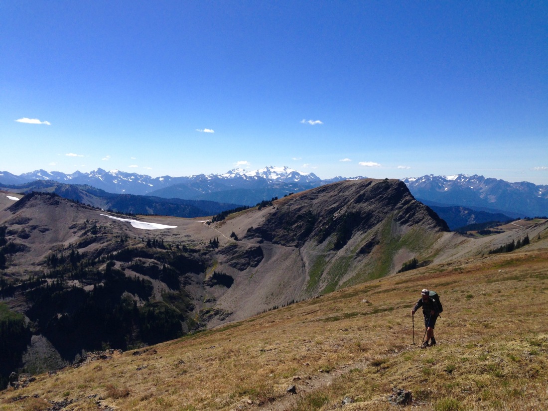
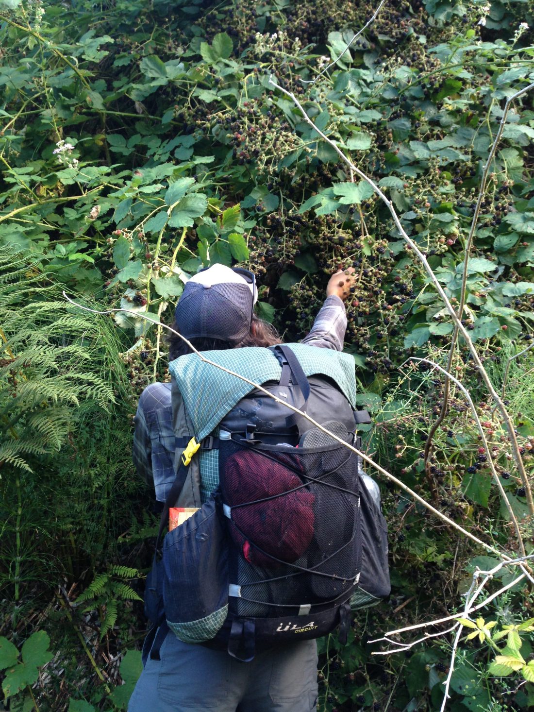
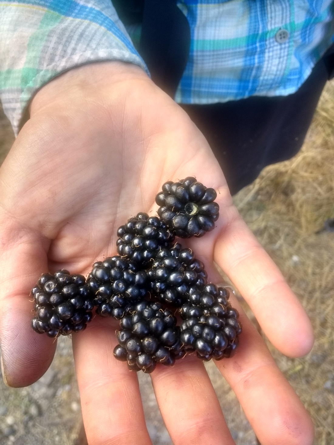
After a Chinese Buffet, food resupply, a shower, and a night inside at a nice hostel in Port Angeles, we headed back up to Hurricane Ridge. Our now easterly route took us across the ridge to Obstruction Point and around Elk Mountain before heading down and out of the Park. The wildfire smoke from the start of the trip had dissipated, so we were treated to some spectacular views. We also started crossing paths with the westbound PNT thru-hikers, and it was super-fun to meet them, chat, and trade trail notes. After exiting the Park, the trail followed many Forest Service roads, which were pleasant but fairly unremarkable…except for the MONSTER blackberries. Some were so large that I could actually feel the weight of one blackberry in my hand, which means it probably weighed about an ounce.


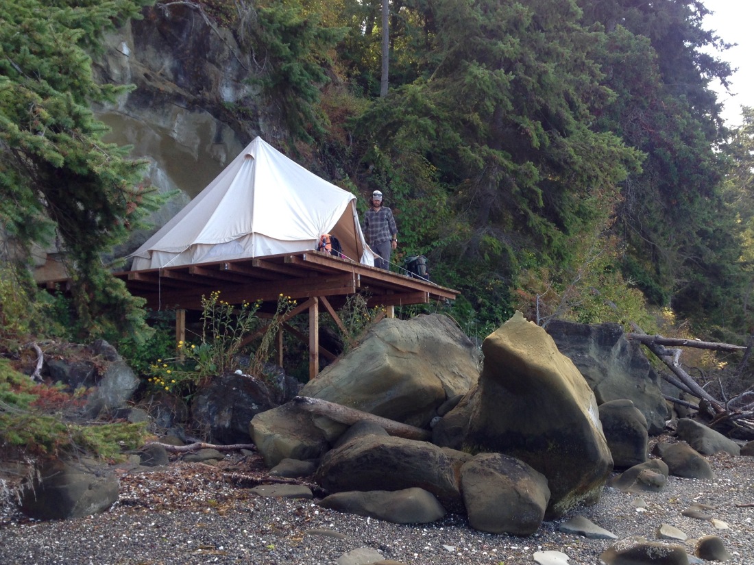
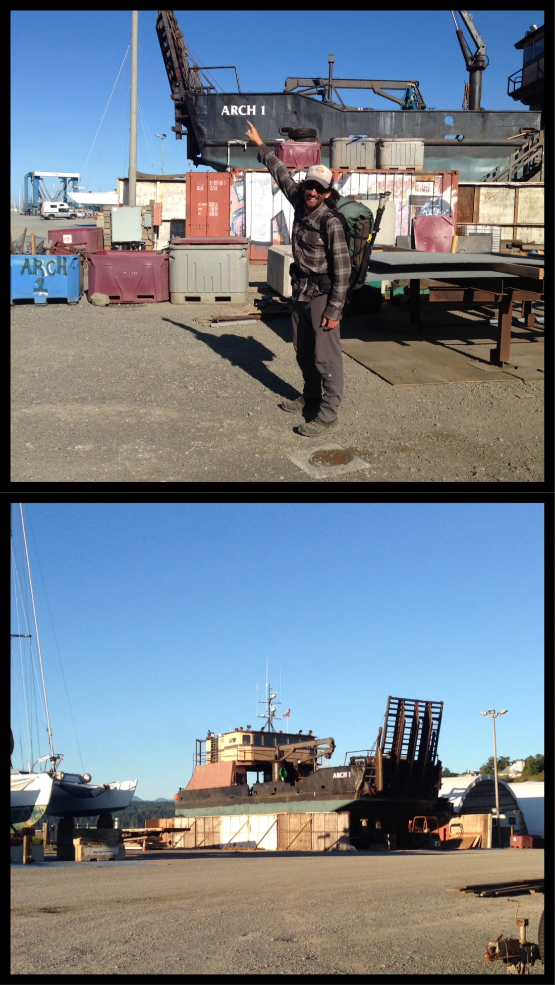
The final section of our trip was less wilderness and more urban. We arrived in the tiny town of Discovery Bay early one evening and experienced the most amazing run of trail magic. While we peered in the windows of the local gear shop, the owner invited us in to look around even though the store was closed. He then asked if we needed anything. “Actually,” I piped up, “could you recommend a place in town for us to camp?” “Let me make a phone call,” he responded. With accommodations set up, we then headed over to Fat Smitty’s Restaurant, where we were graciously seated just minutes before they locked the door for the night, and I watched John demolish their signature massive double bacon cheeseburger. Afterwards, at the General Store, I requested a small cup of ice cream…and was handed the remainder of the 5 gallon tub…for free! Still stunned with this run of generosity, we then got a ride fairly quickly 4 miles up the busy road, and just before dark. When clearing some space for us to sit, the driver handed me a bag of potato chips. (I LOVE potato chips.) Shaking our heads in disbelief at our continued good fortune, we set off to find the tent platform that had been described to us earlier. Our jaws dropped; we stood in awe. It was a platform, all right, with a small canvas tipi tent on it, tucked into the bluff right on Discovery Bay, with a perfect view of an amazing sunset. The next morning we lingered over coffee and wandered the beach at low tide, finding treasures. We finally dragged ourselves away and continued on the PNT to Port Townsend. The trail in that area runs along a lovely bike path, the Olympic Discovery Trail, where we met a young couple who gave us some pertinent town info (best bar with the best live music) and invited us to camp behind their house. Later on, while wandering through the shipyard in town admiring the boats, we were invited to stay aboard a fishing boat from Alaska being repaired in dry dock. A tent in a yard vs a bunk aboard a fishing boat…it was a no-brainer: the boat won.


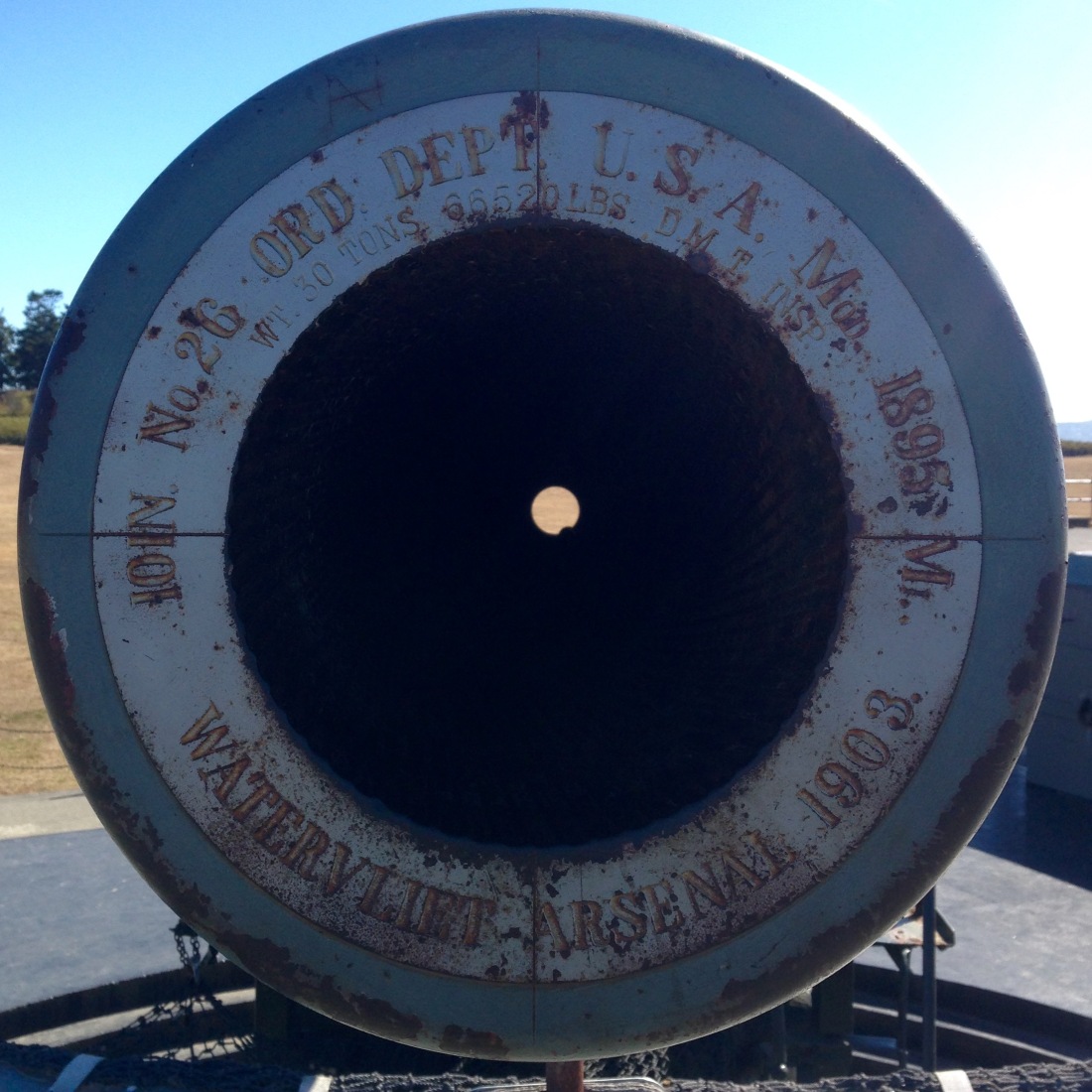
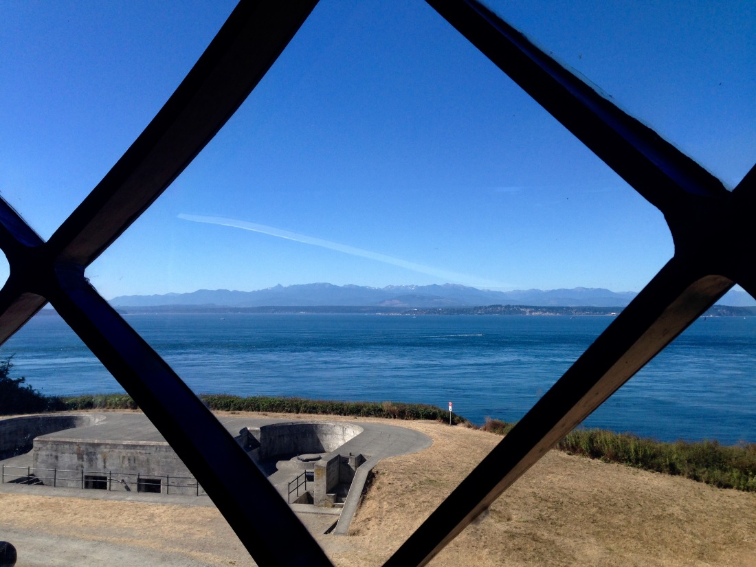
The next morning, thoroughly exhausted by our past few days of travel experiences, we stumbled aboard the ferry to Whidbey Island and ambled up the trail (another beach walk) back to The Happy House, exploring Fort Casey along the way. Upon leaving the beach to walk our final mile, we were offered burgers, hot dogs, and drinks by a picnicking family. The random acts of kindness that happen when traveling never cease to amaze me and strengthen my faith in humanity.


Trip summary: perfect weather, great companionship, beautiful views, fun hiking, interesting wildlife, and stellar interactions with other human beings. The beach walking was a new experience for me and definitely a highlight. I’m glad we extended our trip up the coast to Shi Shi. That being said, there’s a lot more exploring to do in the belly of the Olympic mountains, and I look forward to future trips in the area.

Great write up of your Olympic adventures!
LikeLike
Thanks!
LikeLike