“WOW, THOSE ARE SOME BIG TIRES YOU’VE GOT THERE!”

img_20180705_194916365_hdr.jpg
Fat bike beach love.

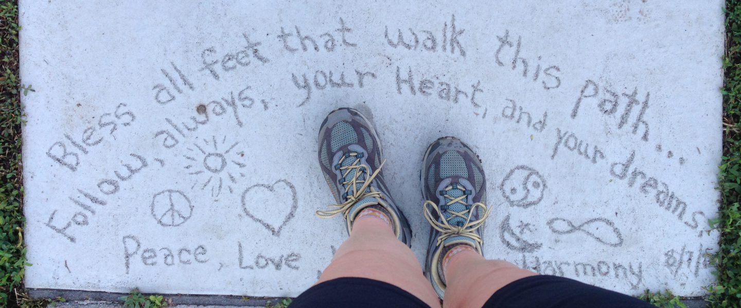
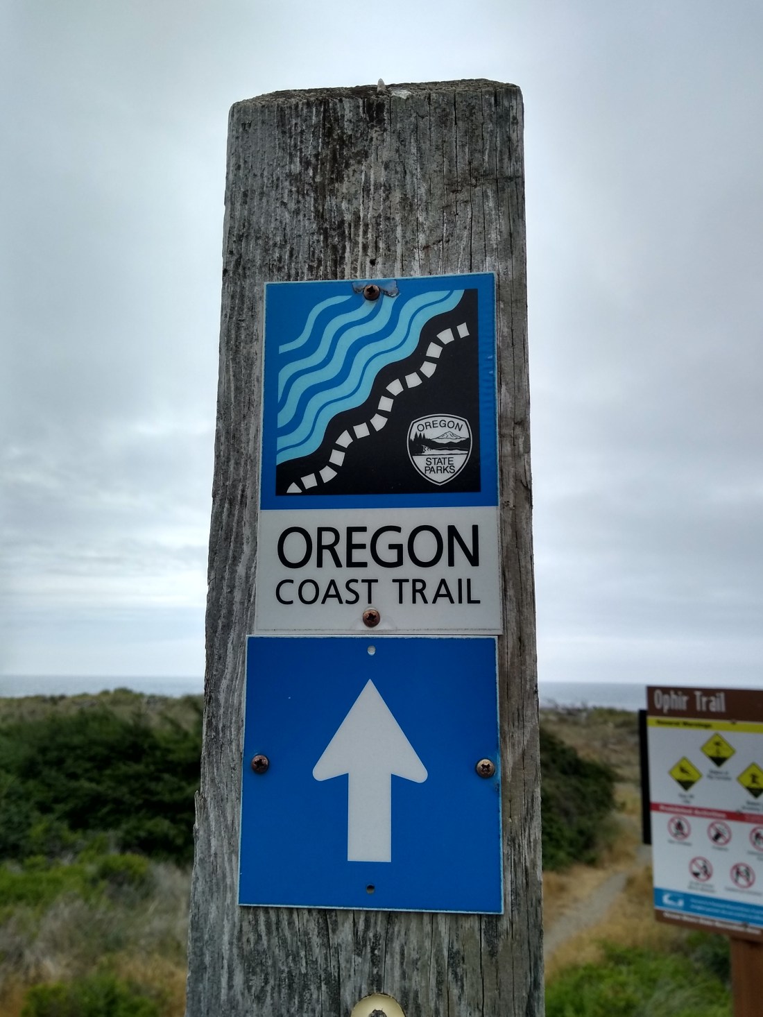
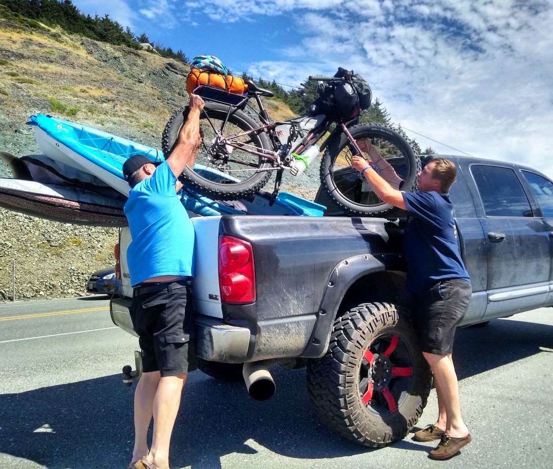
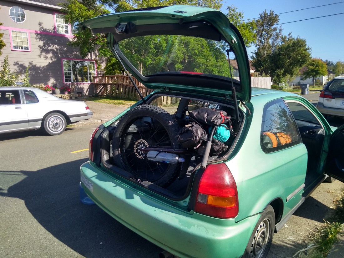
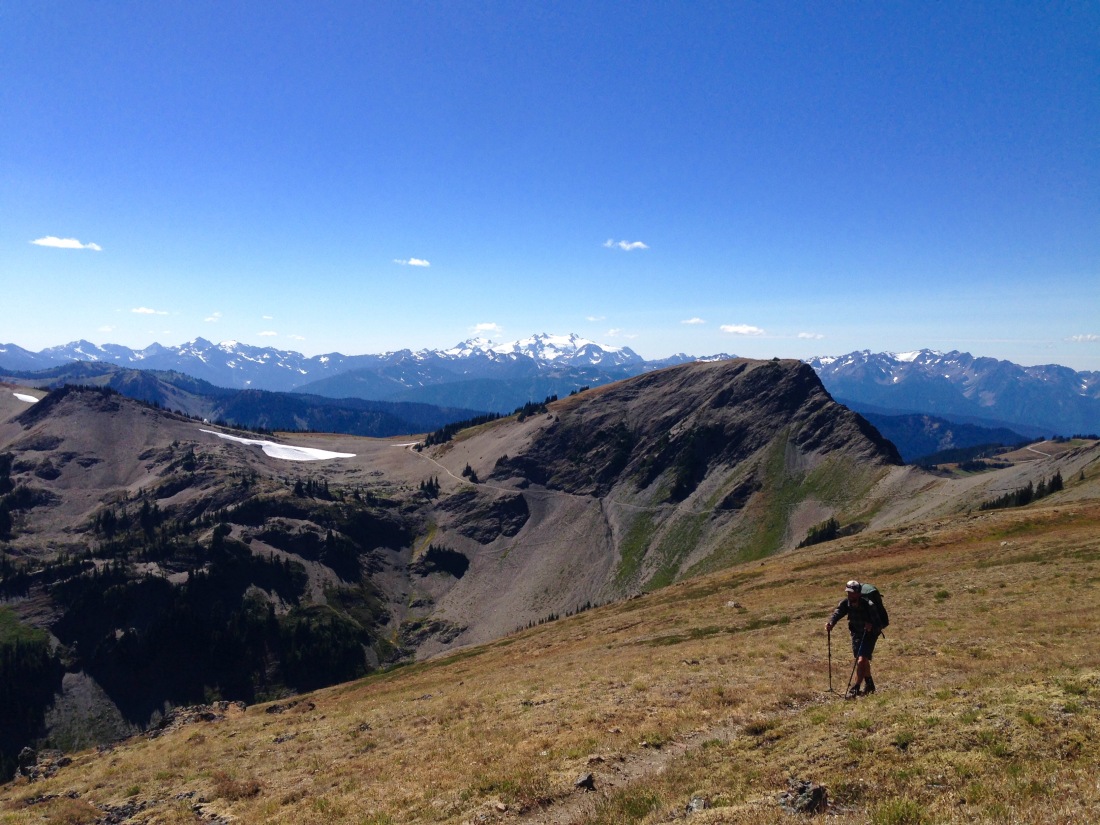
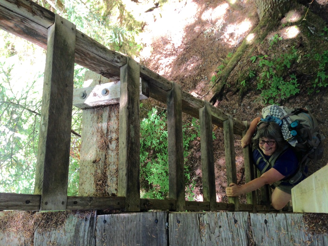
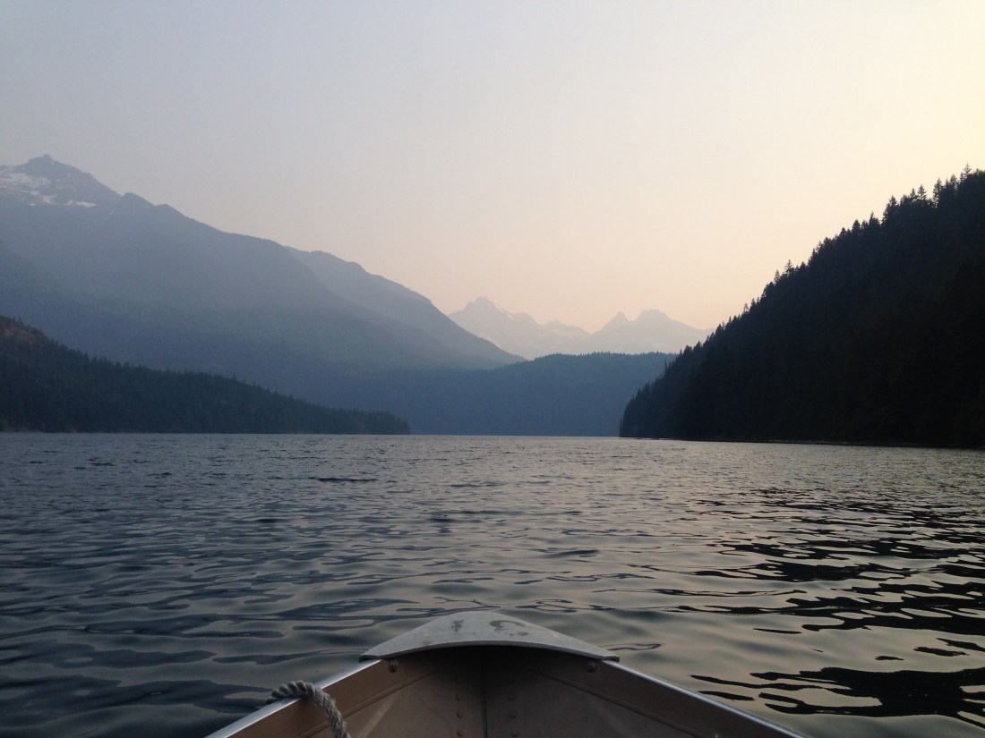
The Oregon Coast Trail had been on my radar for quite some time, so when I saw that I would be in the vicinity this summer, and with my fat bike in hand, it was kind of a no brainer to go check it out.  I had about 10 days of free time before my next trip, and place to safely leave my car at a friend’s house in Arcata, California.  So I parked the car, loaded up the bike, and hitched my way north to Bandon, Oregon, to start my trip back south.  The goal: to ride as much beach and trail as possible, using the OCT as a rough route for the first half.

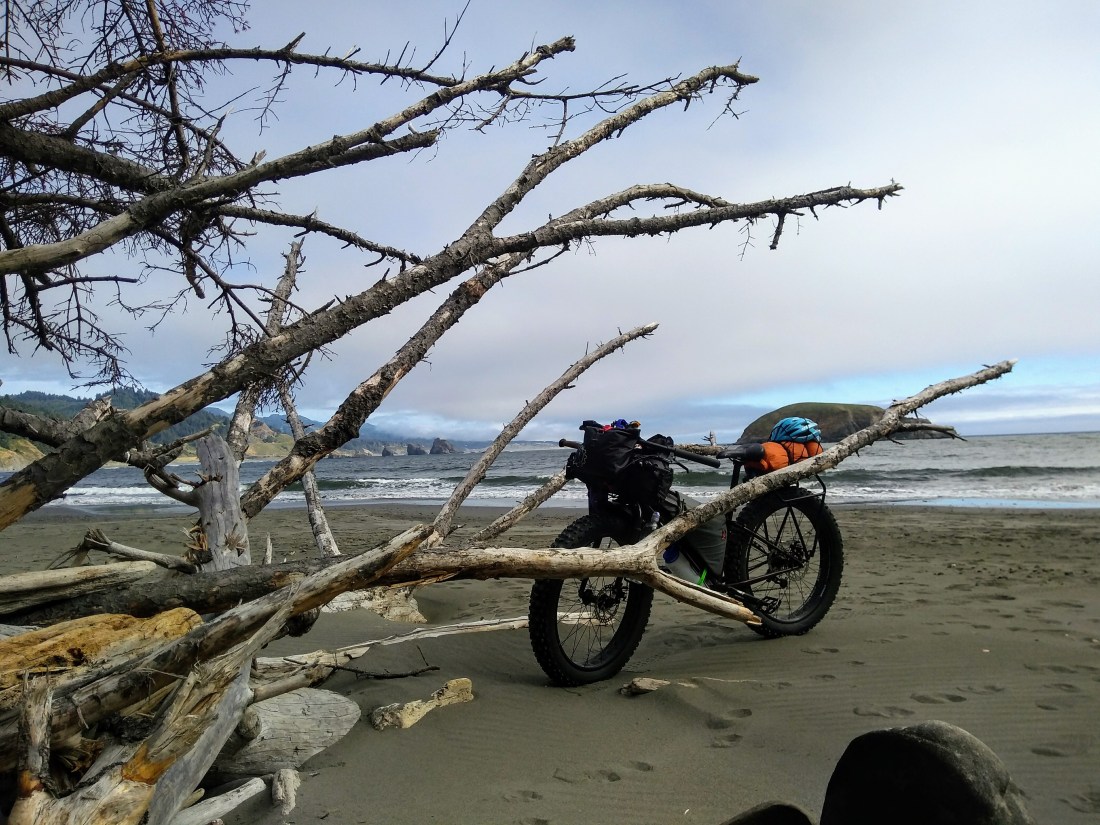
My bike was a source of much wonder and curiosity wherever I went, and I often heard comments to the effect of, “Wow, those are some great big off-road tires you’ve got there!”  Some people had never seen a fat bike before, and on the flip side, avid cyclists flocked around it, drooling and asking questions.  And one conversation with a California State Park Ranger in particular left me giggling: I was looking for information on some beaches I was about to ride and he kept trying to point me in the direction of the paved bike path.  (Fat tires are not optimized for pavement.)  After a lot of explaining on my part, I still don’t think he understood what it was I was doing.  “People generally don’t want to ride their bikes on the beach.”

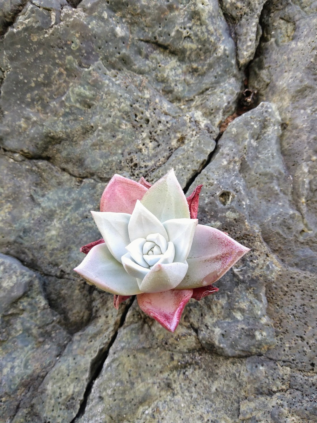
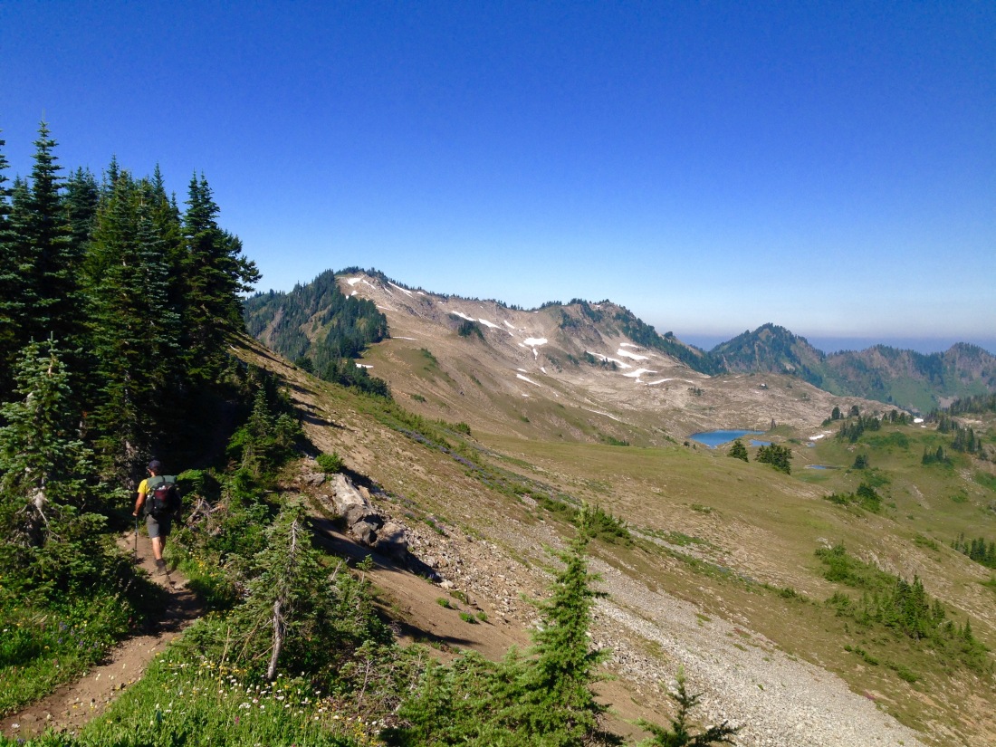
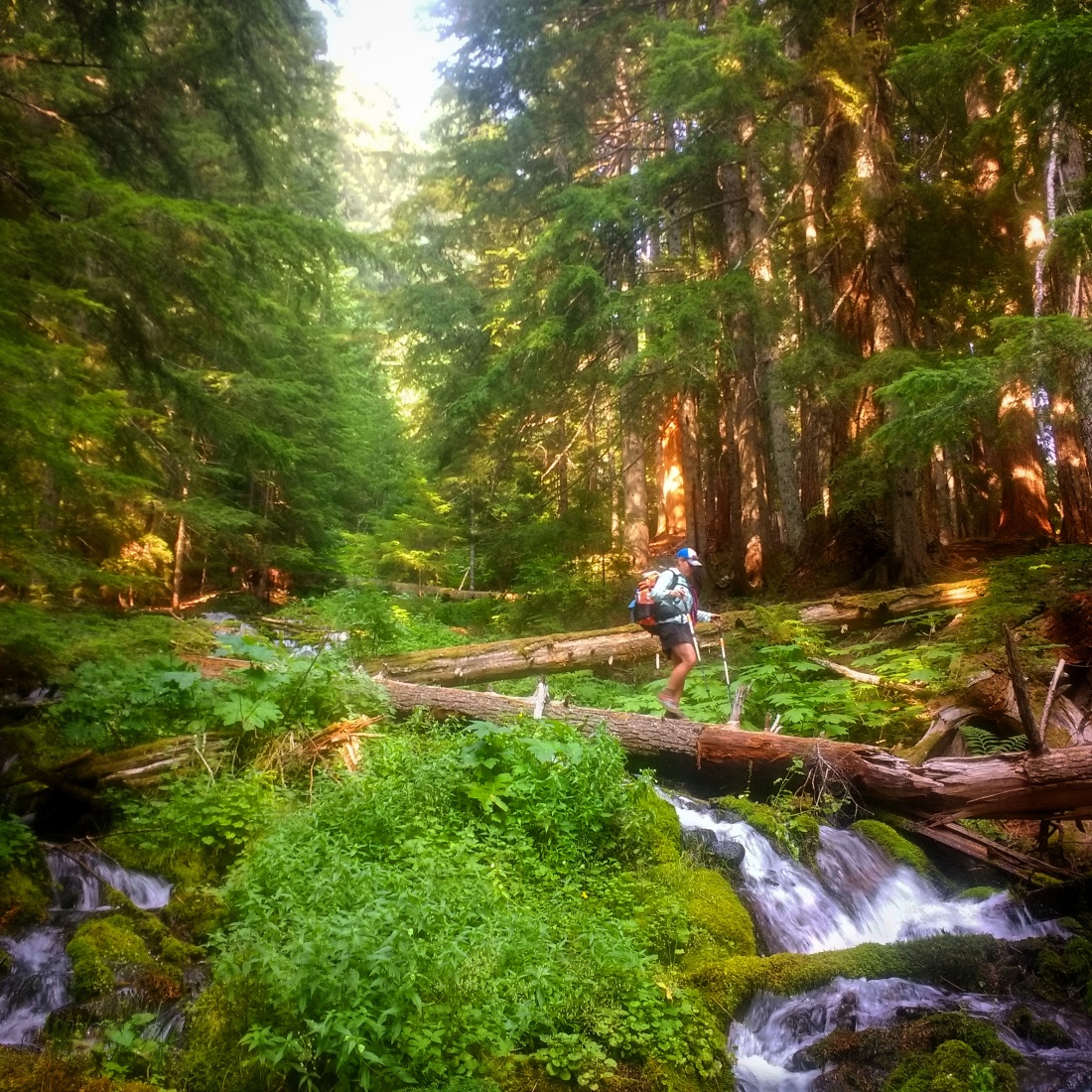
The southern Oregon and northern California coastlines are remote and rugged.  A collection of small towns and villages spaced about 30 miles apart exist in lieu of major population centers.  Much of the coast is protected land, and a large portion of the California coast I traveled is home to the Redwoods National and State Parks.  Due to the rugged nature of the coast, there are no long, unbroken stretches of beach to ride, as they are often interrupted by rocky headlands.  Knowing access and egress might be a challenge, I approached this trip as a full-on exploration of all adventure possibilities, not just a beach ride.

IMG_20180704_145600737_HDR.jpg

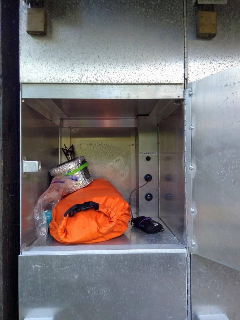
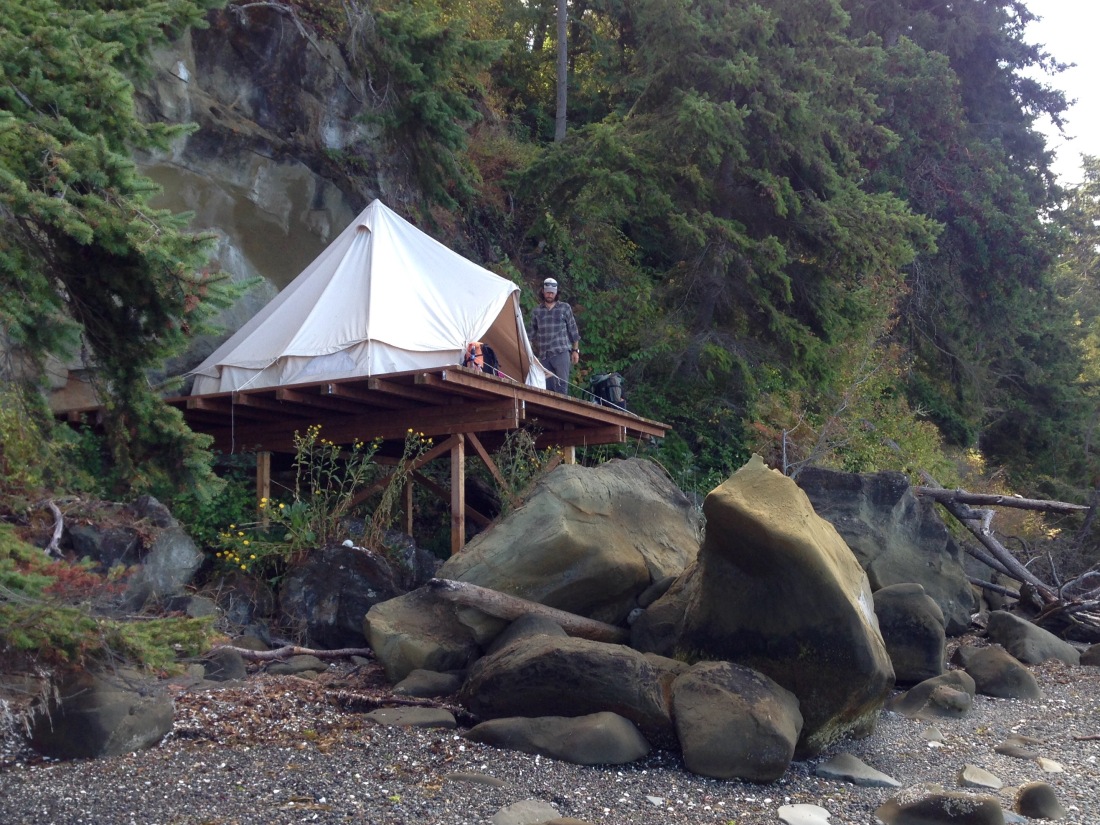
Thanks to the kindness of four complete strangers with vehicles large enough to fit me and my loaded bike, I arrived at Bullards Beach State Park in good time and quickly occupied a hiker/biker site.  $7 is a pittance to pay for having a nice campsite, free hot showers, running potable water, a picnic table, and a privy.  And THIS particular site absolutely knocked my socks off with food lockers that also contained solar-powered USB charging stations.  Winning!

IMG_20180701_201739107.jpg
Food locker with solar powered USB charging ports.

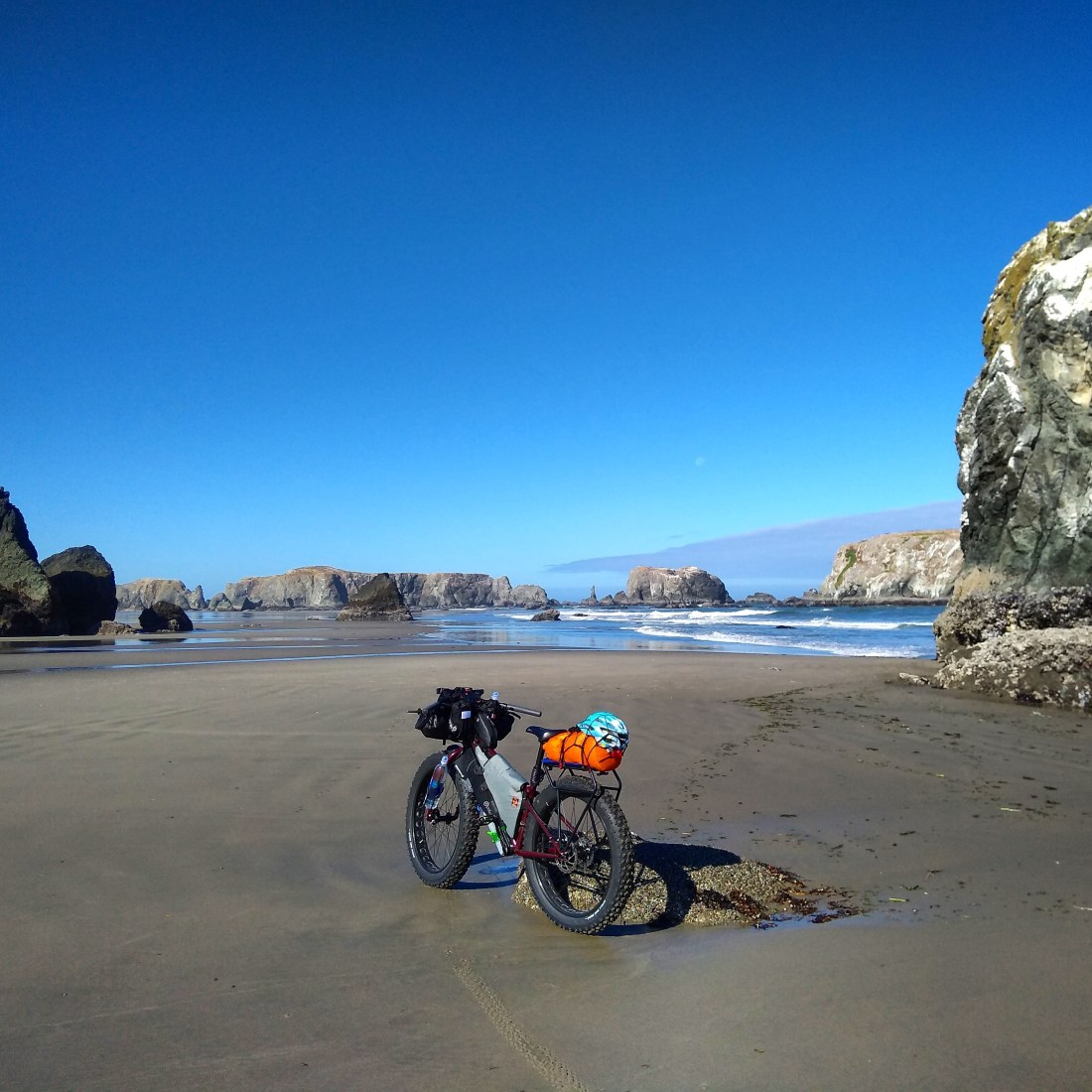
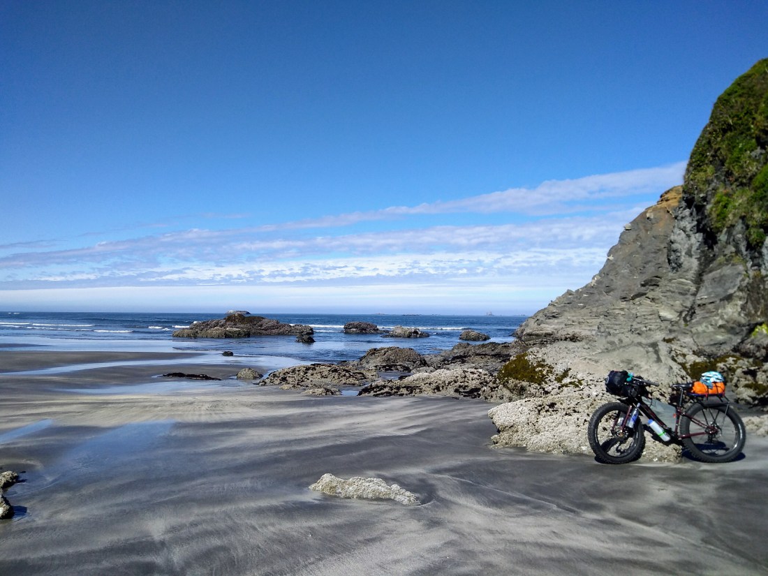
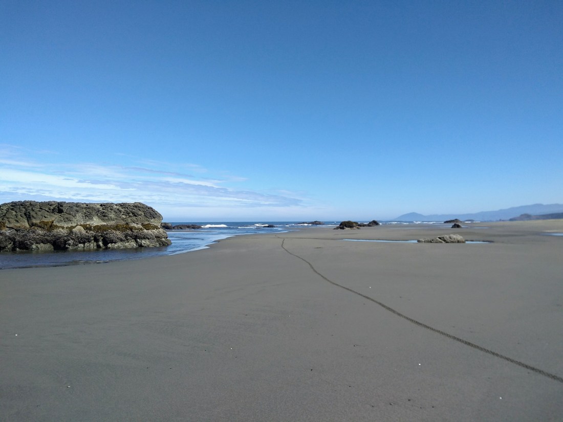
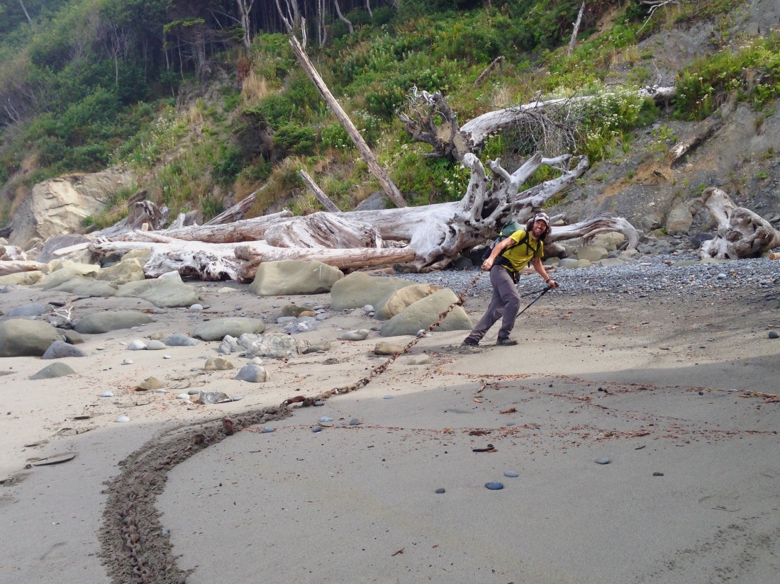
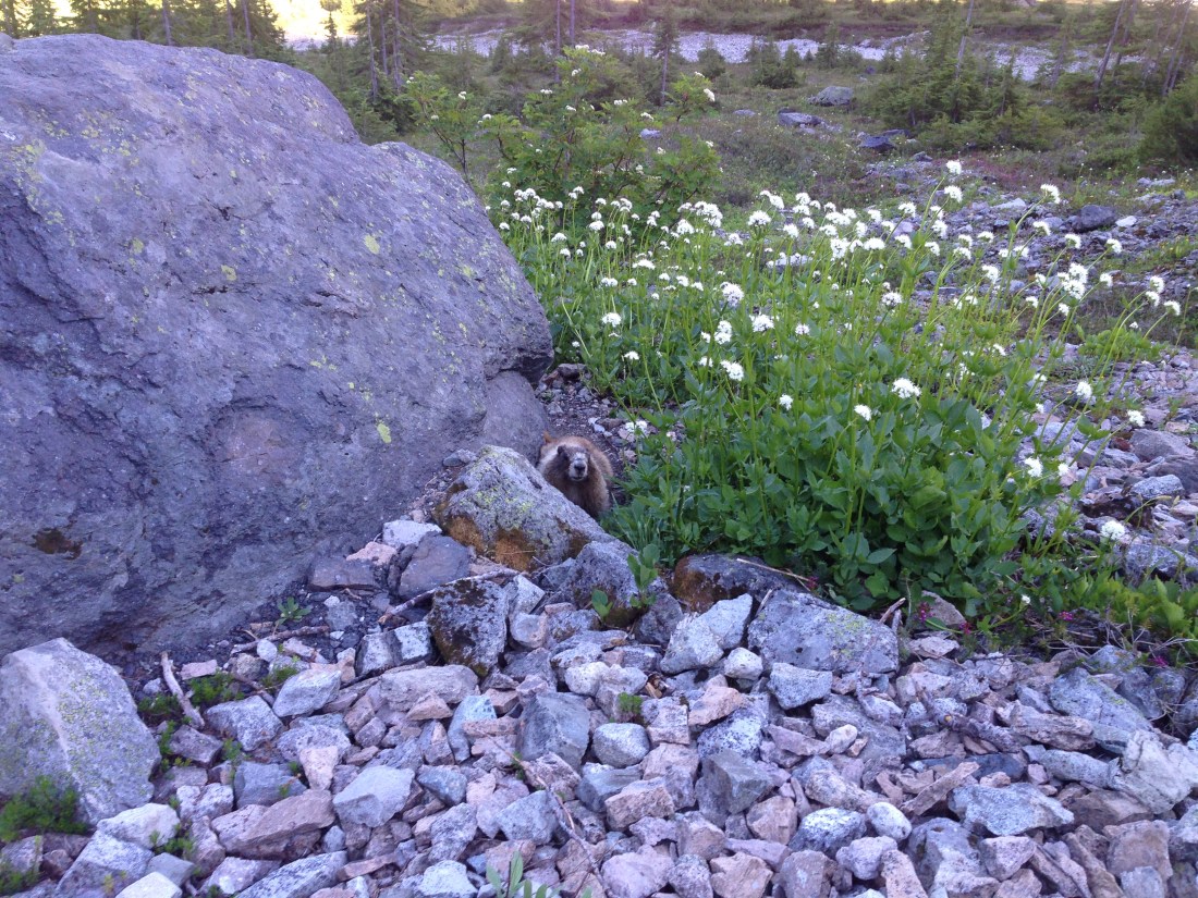
The next day was an epic trip all in itself.  A pleasant side road took me right to Bandon’s South Jetty, where a nice gentleman in a truck chatted me up about my bike’s big tires and travel in general.  After lowering my tire pressures, I hopped down to the beach for my first few miles of sand, literally riding in circles around the sea stacks, and stopping to speak with a Fish & Wildlife volunteer about the Black Oystercatcher birds nesting on some of the stacks.  On I went, earning stares and smiles from other beachgoers, all of them on foot.  (On this whole trip, I encountered no other beach bikers.)


IMG_20180703_151532_211.jpg
Sea stacks on Bandon Beach.
IMG_20180702_093229702.jpg
Sand labyrinth on Bandon Beach.
IMG_20180702_092238326.jpg
Bandon Beach

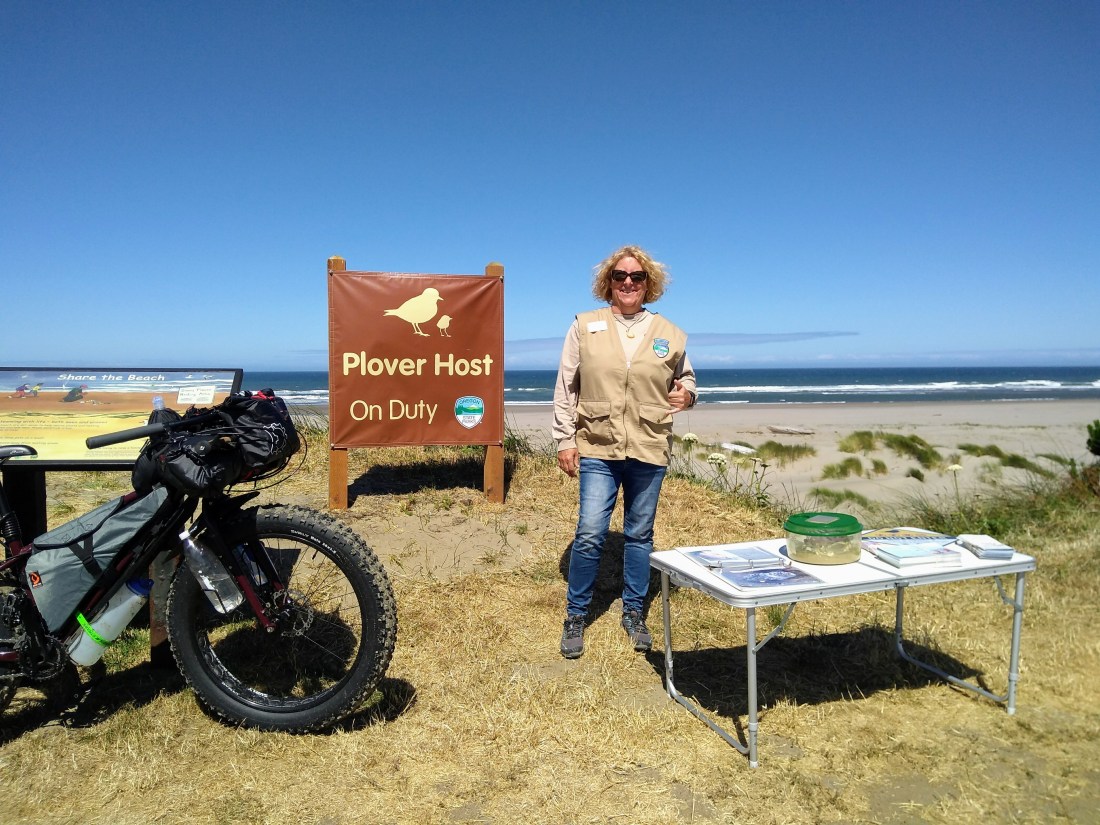
The people pretty much disappeared from the beach as I headed south to China Creek, where 12 more miles of nice, wet, dense sand stretched before me, along with a sign stating that the area was closed to bikes in order to protect the nesting Snowy Plover.  The State Park volunteer in the parking area confirmed that fact as she guided me to the trail up the dunes to her location.  Beth not only provided me with information regarding the endangered bird, but also some fun conversation about adventuring as I prepped my bike and self for a short road ride.

IMG_20180702_101419488.jpg
No bicycles allowed, even though the Plover nests in the dunes and not on the wet sand where I would ride.  😦
IMG_20180702_105641791.jpg
Beth and her Snowy Plover informational display.


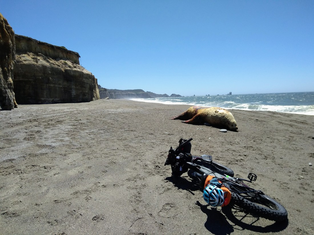
I made quick work of the road miles, explored off-road areas, and returned to the beach at Floras Lake, a popular kiteboarding location.  With an incoming tide on steep sand, I was largely relegated to riding the shelf of soft sand below the cliffs.  After viewing a dead sea lion (massive creatures!)  I reached the end of the beach and took a nice, long break, just listening to the hypnotic sound of waves breaking.

IMG_20180702_143207944.jpg
Beached sea lion.

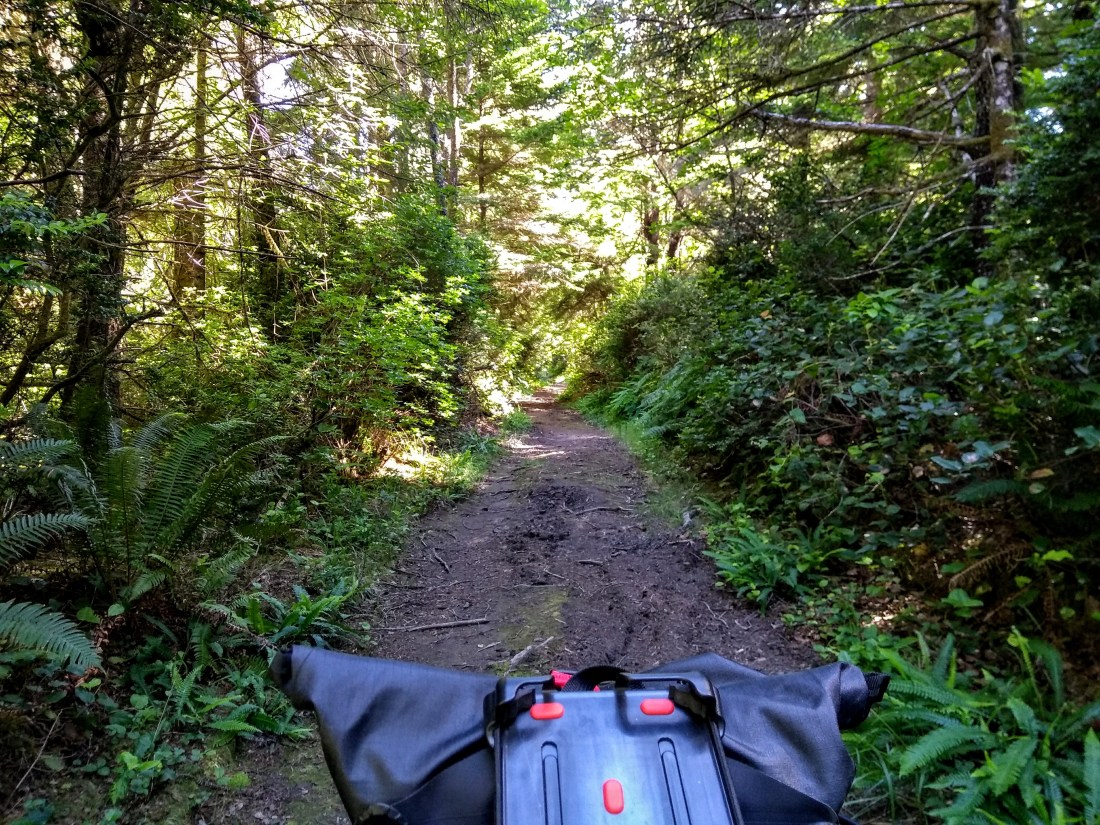
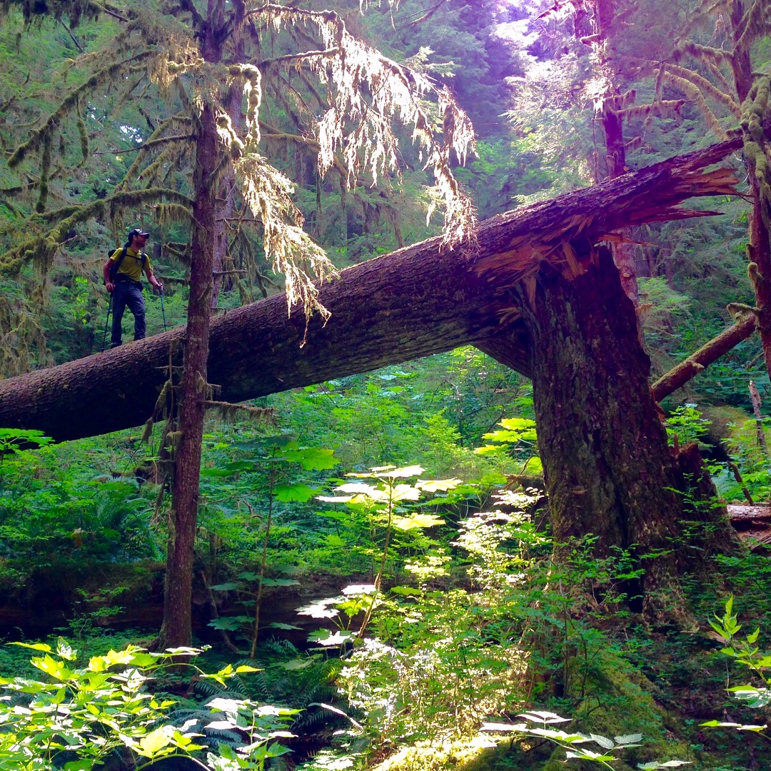
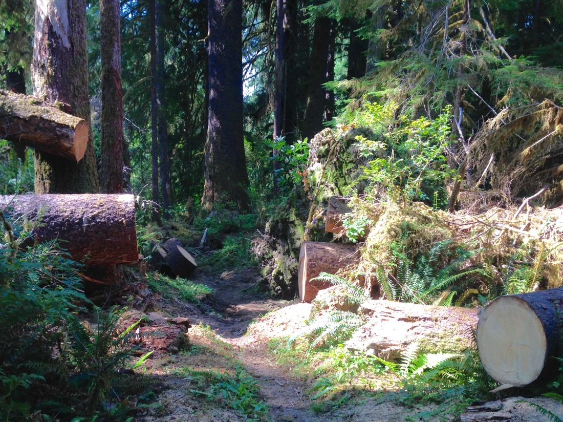
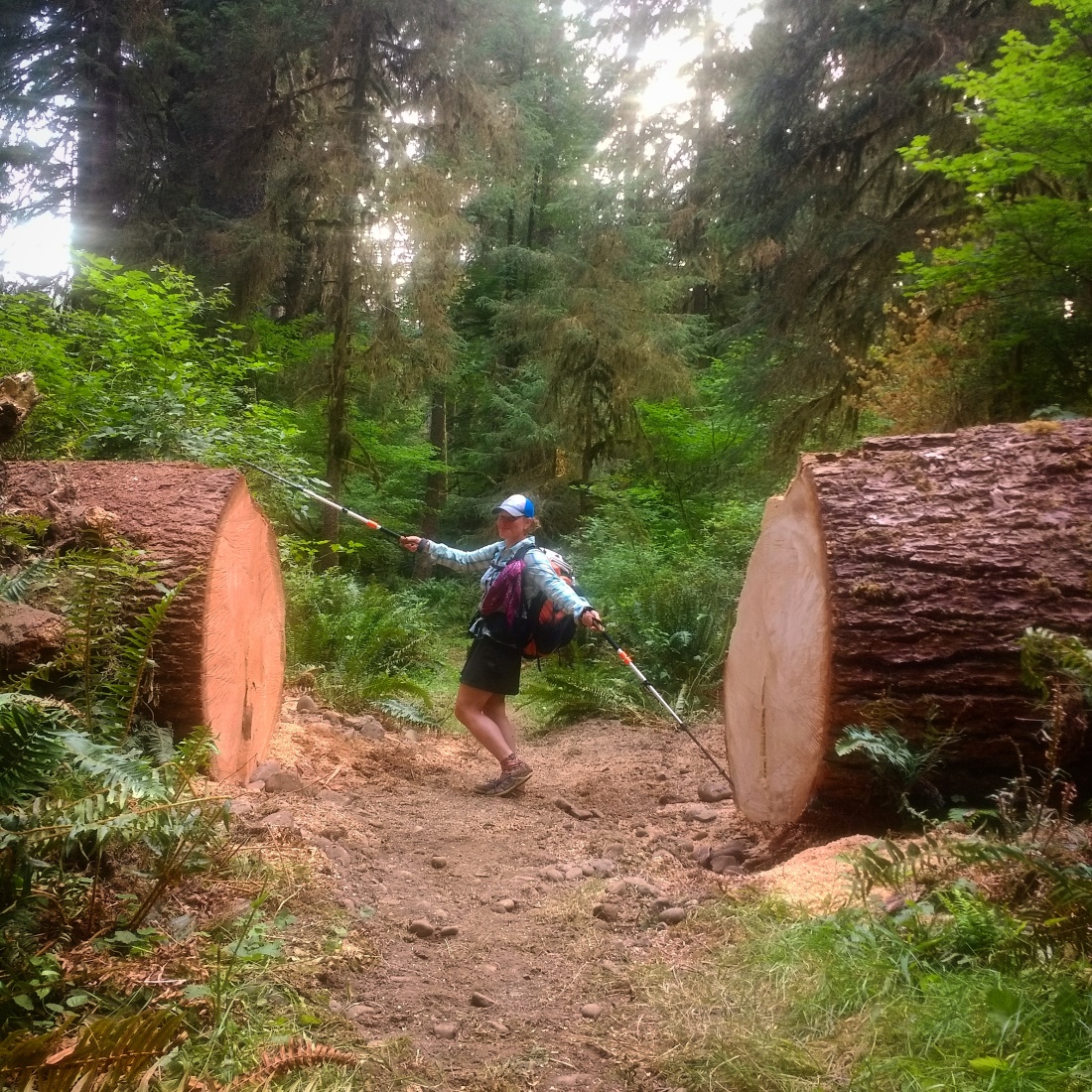
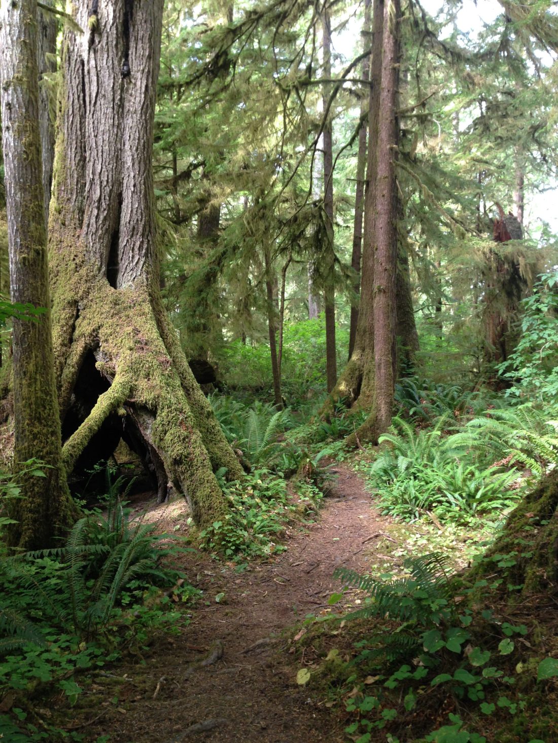
The trail to get off the beach ended up being an hellacious bushwhack.  Waist high dense brush combined with massive driftwood to actually get to the trail, then a steep push up the super-narrow and massively overgrown path.  A loaded fatbike is not lightweight, nor small, and I had to do some fancy footwork to even fit on the so-called trail.  Shuffle, shuffle, push, untangle.  Repeat.  Eventually, I popped out on a legitimate trail, breathed a sigh of relief, and pedaled on.

IMG_20180702_154156825.jpg
The bushwhack…see where it looks like there’s a hint of a trail in front of me? It was actually a series of buried and downed driftwood trees 2′-3′ in diameter.
IMG_20180702_163249958.jpg
Yay, trail!

I navigated down good trails past the end of the runway at Cape Blanco State Airport and out to Blacklock Point.  The views there were fabulous, and as luck would have it, there was one spot shielded from the wind and big enough for my tarp.  Home for the night!

IMG_20180702_170423004.jpg
Cape Blanco State Airport
IMG_20180704_191154_174.jpg
View of Cape Blanco from Blacklock Point.

The next day I pedaled over to Cape Blanco State Park and its lighthouse, of which I had a view from Blacklock Point.  After riding the bluff trail, I settled in at a picnic table to eat and weigh my beach riding options.  There was a lovely stretch of beach in front of me, but with one big unknown: would the mouth of the Elk River be fordable?  The tides weren’t really favorable, and no one I met had any good information.  But what really stopped me from going to see about it was the unusually strong wind, which would push me down the beach at record pace, but would also make my life hell for a few miles should I need to come back.  I ultimately decided to skip the beach this time.

IMG_20180703_121528623.jpg
The bluff trail at Cape Blanco.

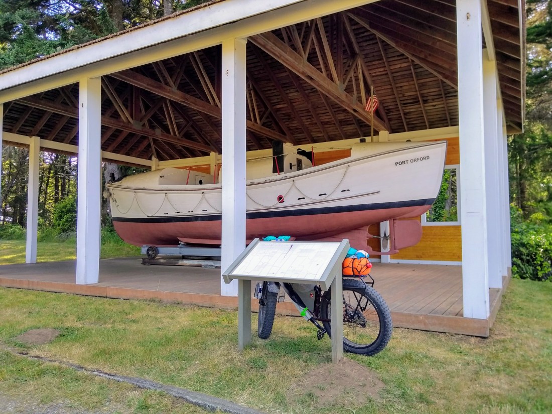
Next up was an early evening exploration of Port Orford Sate Park, home of the US Coast Guard Lifeboat Museum (unfortunately closed.)  There were some short hiking trails with specific signage prohibiting bikes, so I locked up my steel steed and went for a ramble around the cape, taking in the beautiful ocean views and learning about the area history.

IMG_20180703_163350144_HDR.jpg
Lifeboat exhibit at Port Orford State Park
IMG_20180703_174501454.jpg
The well-appointed roadside Port Orford Bike Station.

One more beach section followed by another heinous bushwhack, and I was back on the dirt and deteriorating pavement of the Old Coast Highway, which is now part of the Oregon Coast Trail and closed to motorized vehicles.  There were several suitable campsites in this section, it was getting past dinner time, and I was tired, but the voice inside my head said, “Go to the hiker/biker site at Humbug State Park!”  And who was I to argue?

IMG_20180703_180232969.jpg
Sea stacks near Battle Rock, Port Orford.
IMG_20180703_192054539.jpg
Old Coast Highway

As soon as I arrived I knew why the universe wanted me there (besides the electricity and hot showers): I met a new friend, an OCT thru-hiker, Hawkeye, who had been hiking the entire OCT from the northern tip of Oregon.  He shared his Elk River crossing story, which included a brief brush with death as he (at 6’ tall) barely made it across in armpit deep water while holding his pack over his head.  I definitely made the right decision to skip that one.

IMG_20180704_095556527.jpg
OCT Thru-hiker Hawkeye

Over the course of the next few days I enjoyed a bunch of fun beach riding and challenging bushwhacks, meeting up with Hawkeye in spots.  He got to enjoy some sections of beach where I had to backtrack due to impassable headlands (impassable for the biker, not the hiker.)  But I was pretty psyched that I got to ride by my favorite roadside T-Rex.  I’m a sucker for roadside attractions.

IMG_20180704_140631397.jpg
T-rex!
IMG_20180704_133118885.jpg
Arizona Beach

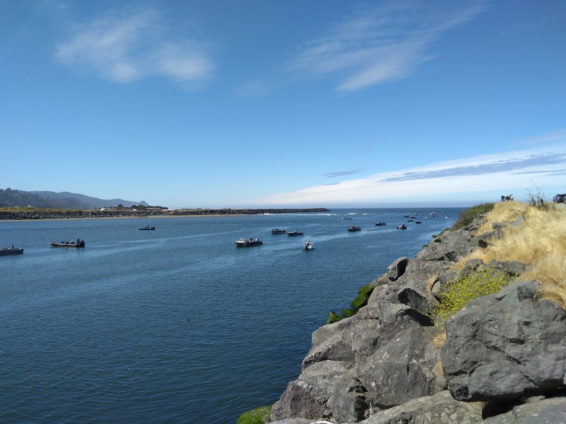
By the time I reached Otter Point, I had finally learned my lesson about beach access trails, and thus I actually hiked down to scope it out before bringing my bike down it.  And I found…AN ACTUAL TRAIL.  I was even able to ride down it!!!  What a revelation.  The beach riding was great: just the right sand density, low tide, sunny, warm, with some boulders to check out and a few sea stacks just offshore.  There was a chaotic scene of fishing boats at my takeout at the North Jetty of the Rogue River.  Apparently the mouth of the river had recently been dredged and word got out that the salmon were running.

IMG_20180705_090755664.jpg
Rideable beach access trail!!!
IMG_20180705_092442594.jpg
Otter Point State Recreation Site
IMG_20180705_094857981.jpg
Otter Point State Recreation Site
IMG_20180705_102341568.jpg
Salmon run at the Rogue River

After a brief library and grocery stop in Gold Beach, I headed back to the beach into a crazy headwind.  The prevailing summer winds are from the north, but these were from the south.  It was not a pleasant beach ride, to say the least, and I also needed to get around the headlands of Cape Sebastian by going uphill on pavement into the headwind.  So, quite reasonably, I bailed out at the first possible road access point and promptly stuck my thumb in the air.  Five minutes later, a family stopped to give me a ride.  They made room for my bike in the seemingly full pickup bed, then drove me 6 miles down the road to the next beach.  Phew!

IMG_20180706_173518_520.jpg
Saved from brutal headwinds, uphill, and pavement by the kindness of strangers.

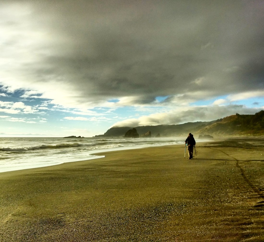
I took a nice, long break in a sheltered area of the beach, used a driftwood tree as a bike rack, watched the tide come in and start to go back out, then continued south.  This beach had something new to offer: dunes of soft sand which were actually fun to ride (in small doses,) and quite necessary at times because the tide was still fairly high.  During another break I spotted a lone hiker in the distance behind me.  It could be only one person: Hawkeye!  We camped together and commenced with storytelling about our Cape Sebastian experiences.

IMG_20180705_174220853.jpg
The driftwood bike racks were awesome!
IMG_20180708_130857_962.jpg
Hawkeye making his escape from Cape Sebastian.

The OCT turns off the beach a couple miles south of the Pistol River at a rocky headland.  The trail was in better shape than the other ‘shwacks I had done thus far, but it was still overgrown, and started with a tall, steepish dune to boot.  I employed Hawkeye to help with the bike push effort, and we made quick work of it.

IMG_20180706_093541091.jpg
We pushed the bike clear over the top of the dune to avoid sliding down the side into the driftwood pile.

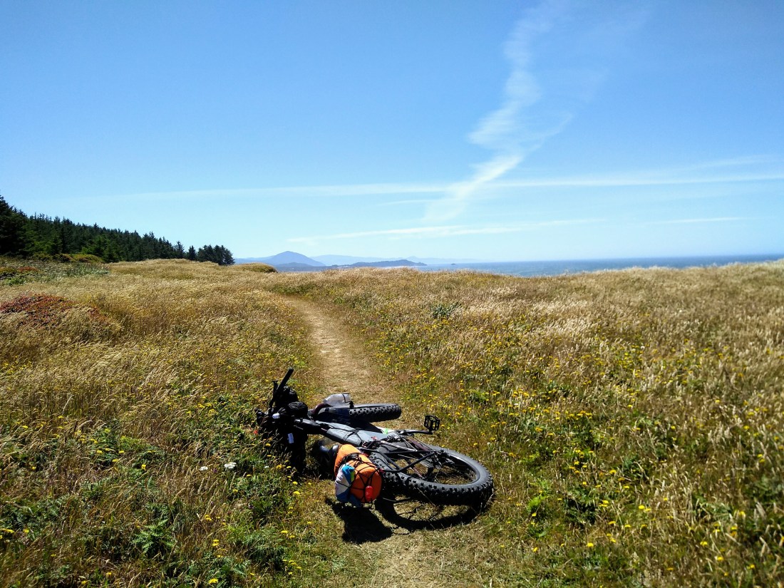
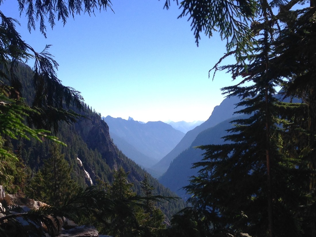
The 12 mile Samuel Boardman Scenic Corridor is a rugged stretch of coastline defined by many cliffy headlands and limited beach access.  The OCT is narrow and steep forest hiking trail through here (unrideable,) and the only road option is the 101.  So it was time to ride the road and stash my bike at key points along the way for hikes to the special spots, such as Secret Beach.  Based on the number of people who were there, it’s not actually a secret, but it was a fabulous place with a very Goonies-esque feel.

IMG_20180706_142848795.jpg
Secret Beach

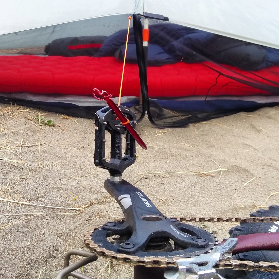
The sun on the road was harsh, plus it takes FOREVER to get anywhere with those fat tires, so I was definitely ready for another plush hiker/biker campsite, this time at Harris Beach State Park.  The hot water of the shower on my legs confirmed the degree of sunburn.  Ouch!  There was a great bike stand at Harris, so I was able to really get some good maintenance done.  Sand and salt does a number on the drivetrain.

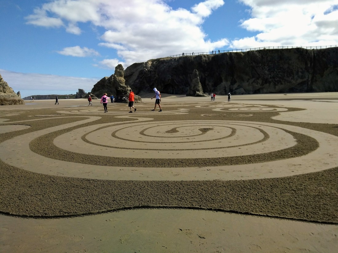
Hawkeye caught up the next morning as I lazed about the campsite.  It was his last day on trail, and I wanted to celebrate his accomplishment of completing the OCT with him at the California border.  After a food resupply, I followed the official coastal bike route a few miles to Chrissey Field State Park.  My timing was perfect: I had turned about two circles in the sand when Hawkeye arrived.  After photos and a quick break, we parted ways, he heading north back to Harris Beach and beyond, and me heading south along the beach into the unknown and wild land of California.  With very little information in hand about the CA coastline, this is where the real exploration began!

IMG_20180707_151314368_BURST002.jpg
Goodbye Oregon and hello California!

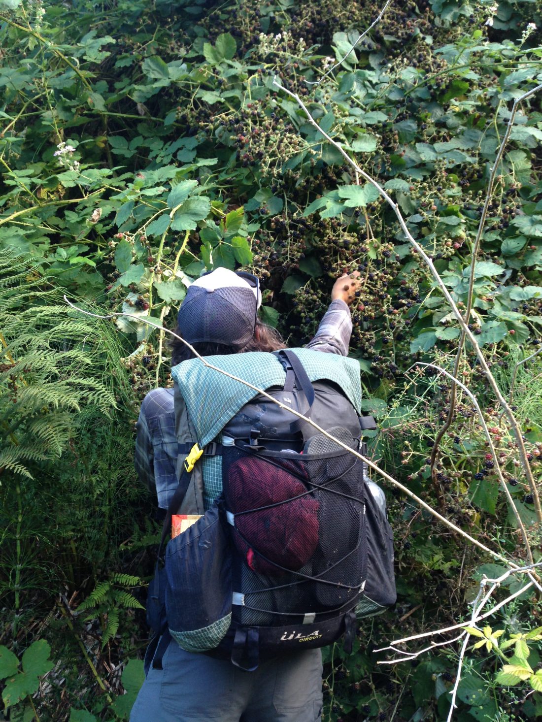
I could see a rocky point just about a mile ahead and decided to investigate it.  There was actually a way through with minimal rock scrambling, so I went for it in order to stay on the beach.  The tide was coming in, but I was able to make it nearly the whole way to the mouth of the Smith River with just minimal interference from rocky points.  At the mouth I spoke with a local woman who said that in decades of living there she’s never seen it shallow enough to cross on foot.  Without any boats about, I was forced to hit the road again.  Such a shame, too, because just on the other side of the river was a 10ish mile stretch of beach, Tolowa Dunes State Park.  Oh, well.  I’d get it from the other side.  I continued on to some hiker friends’ home in Crescent City, where I ate fish tacos and slept in a comfy bed.  Many thanks go out to Hop-a-Long and the Lorax for their generosity!

IMG_20180707_163110303.jpg
It was a short scramble, carrying and maneuvering the bike over those boulders to find the rideable sand.
IMG_20180710_133108_243.jpg
Mouth of the Smith River and Tolowa Dunes State Park on the other side.

After a much-needed day off, Hop-a-Long gave me a lift as far north as possible at Tolowa Dunes.  The access trail to the beach was sandy, but otherwise in great shape and fully rideable.  Upon reaching the beach, I actually headed north a few miles, to see the mouth of the Smith from the other side.  My efforts were rewarded by the presence of a big group of seals!  I watched them watching me for a few minutes, and then set off southward, intent on reaching Crescent City by beach.  My progress was blocked about 2 miles from town, however, when I came across a breached and impassable lagoon.  Ces’t la vie.  There are worse places to have to backtrack.

IMG_20180709_125504184.jpg
None shall pass this breach.  It was much deeper than it looks.

I had already planned to hitch from Crescent City to Klamath around a particularly gnarly section of cliffs and a gnarlier road ride down the 101, so I started my ride-getting efforts after being turned around by the breach.  Eventually a gentleman who was relocating from Wisconsin to Crescent City gave me a ride.  “I’ve been wanting to help someone out, but my car is always full.”  Lucky for me, it was empty at that moment, and he went well out of his way to bring me the 20+ miles to my next trailhead.  Camping in this coastal area is restricted due to the Redwoods National and State Parks, but established backcountry campsites are available with a free permit.

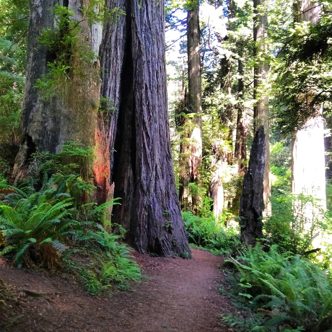
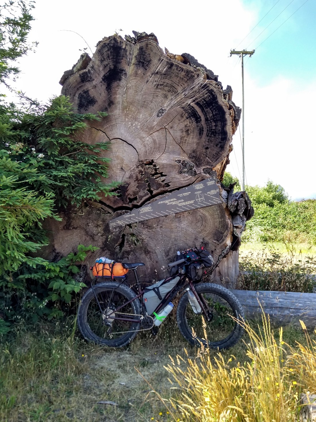
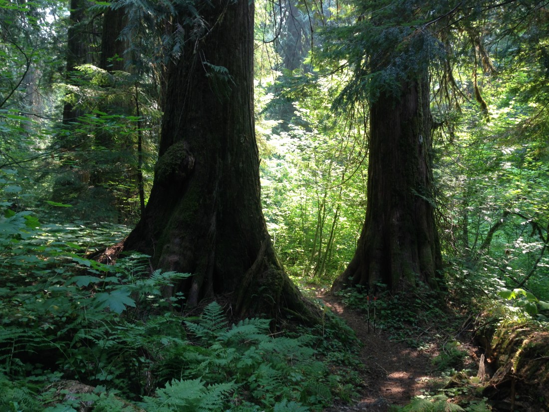
I took the California Costal Trail out of the Flint Ridge camp the next day.  It followed the Old Coastal Highway and was a fun mix of old roadbed and single-track, all of which I was able to ride except for one exceptionally steep, but short, uphill bit.  From the next trailhead was a short stretch of pavement to access the Ossagon Trail – one of the few bike-friendly trails in the Redwoods.  The trail started with a heart-pumping but short-lived uphill through old growth redwoods on a well-maintained track, followed by an 800’ drop over 2ish miles on progressively narrower trail to reach Gold Bluffs Beach.  It was a super-fun downhill!

IMG_20180712_201235_839.jpg
Ossagon Trail before it got narrow.
IMG_20180710_105235761_HDR.jpg
Ossagon Trail

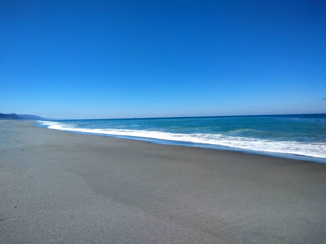
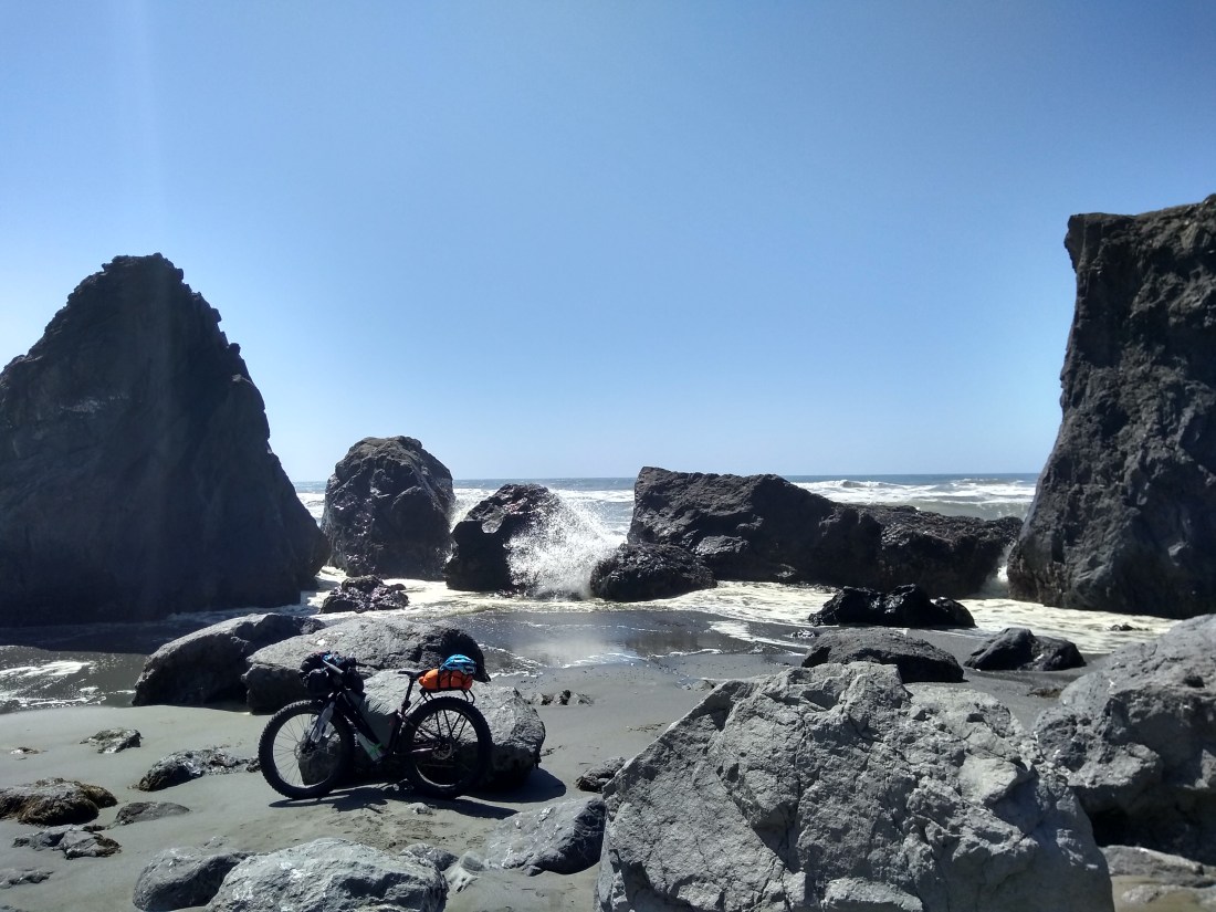
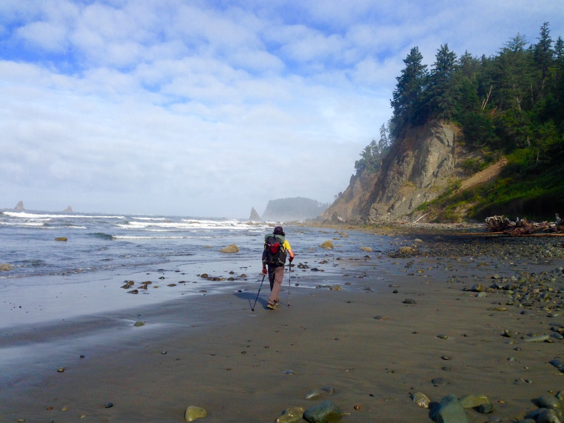
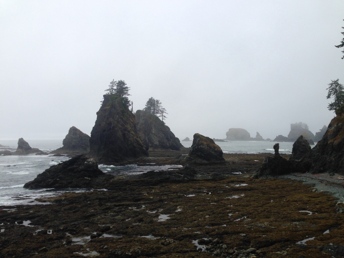
Gold Bluffs Beach is only accessible by road in the mid-section of the beach, so it’s very quiet and remote feeling on the north and south ends.  I went north a bit to Ossagon Rocks and Carruthers Cove, then turned around and rode clear to the other end of the beach at Sharpe Point, about 10 miles.  The beach was spectacular!  Blue waters, seals playing in the surf, gulls, pipers, pelicans…for miles and miles!  There were multitudes of sea birds, including pelicans flying low to the water.  I decided to spend my last night out in this magical place.

IMG_20180713_102842_497.jpg
Gold Bluffs Beach…there are seals in the water, but it’s next to impossible to see them in the photo.
IMG_20180710_115635652.jpg
Plant life on Ossagon Rocks
IMG_20180711_193758_256.jpg
The bike becomes an integral part of the staking process when pitching a tarp on sand.

What goes down must come back up, and so it was that I started my last day with an 800’ climb on a dusty gravel road, then back down to 101.  There were trail alternatives to some of the 101 in that area, and I found a path alongside Redwood Creek that took me from Orick straight to the beach. Score!

IMG_20180711_103648106_HDR.jpg
A slice of 1,000 year-old redwood on display in Orick, along with a description of the various zones of growth.

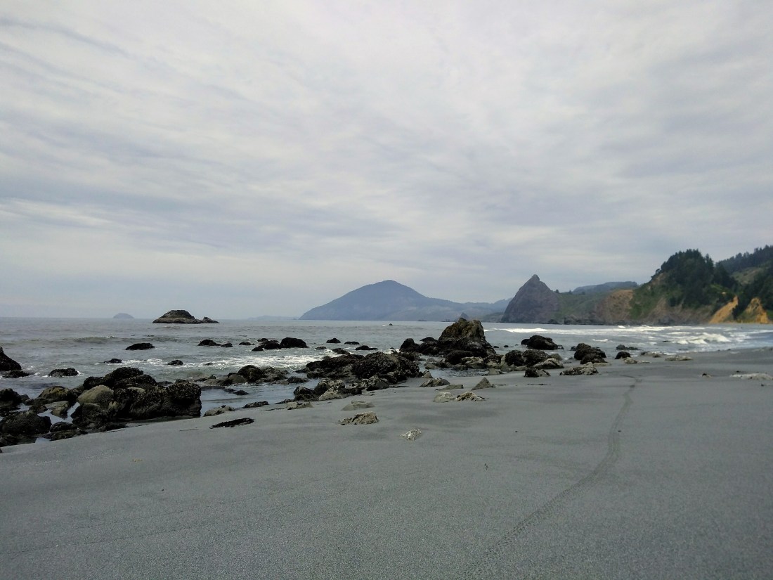
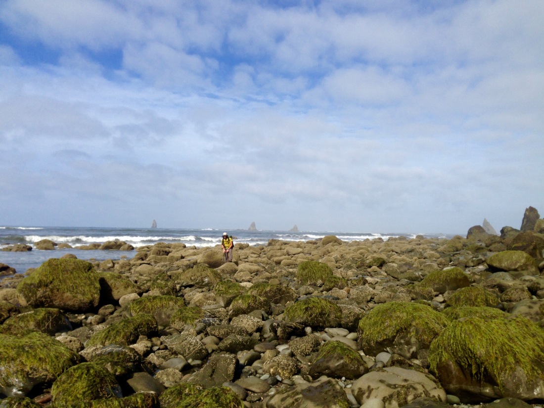
The surf was pretty rough south of Redwood Creek, and the tides not favorable for crossing rocky points.  The beaches at Freshwater and Dry Lagoons were to be my last, and they were definitely memorable, with big waves crashing into the rocks, creating quite the show.  Even at low tide, further passage south was not possible. With my allotted time for this trip used up, I headed out to the road for one last hitch.

IMG_20180711_152822636_HDR.jpg
The end of the trip at Dry Lagoon Beach.
IMG_20180711_154847926.jpg
The trusty steed propped on a driftwood root ball at Dry Lagoon.
IMG_20180711_180358857_HDR.jpg
Just for the record, you can fit a fully loaded (small frame) Surly Wednesday in a ’96 Honda Civic DX.

Three Weeks on the Pacific Northwest Trail: Traversing Olympic National Park

I had assumed I’d be traveling solo for the bulk of my adventures this past summer, so I was pretty psyched when my friend John expressed interest in joining me on the section of the Pacific Northwest Trail that traverses Olympic National Park.  After I completed the North Cascades section, John and I met up at The Happy House to prepare, then set out on our epic journey.  Most seasoned hikers take about two weeks to complete the 200+ miles, but we were complete overachievers and did it in three, ensuring that lazy mornings and swimming were priorities.  The miles we walked took us from Coupeville, WA to Shi Shi Beach…but with a twist.  I’m not ashamed to say that we planned our trip around avoiding hiking a 6,000 foot elevation gain up Hurricane Ridge, also providing ourselves with an additional food resupply in an otherwise long section.  In a nutshell, we started at the top of Hurricane Ridge and hiked westbound to Shi Shi Beach, then returned to Hurricane Ridge and hiked eastbound back to Coupeville.  Hike smarter, not harder.

When we started out at Hurricane Ridge, our views were somewhat obscured by the wildfire smoke that had poured into the area from the fires burning in British Columbia.  We could make out Mount Olympus to the south, but the ocean views were completely non-existent.  We hiked down from Hurricane Hill into the Elwha River Valley and then up to the Seven Lakes Basin.  The basin was a truly spectacular alpine area, above treeline and with many swimmable lakes.  We saw several mountain goats lounging on a lingering snow patch and also a bear feasting on some just-ripe blueberries.  Wildflowers were in bloom, and the smoke slowly dissipated as we hiked through the basin and down into the Bogachiel River Valley.

Hurricane Hill
John hikes west over Hurricane Hill.
FullSizeRender (2)
Smoky views of Mount Olympus from Hurricane Hill.
FullSizeRender (3)
Seven Lakes Basin
Goats
Goats in the Seven Lakes Basin
FullSizeRender (4)
The tiny dot in the center of the photo, located a mere 20′ from the trail, is a bear. He seemed a lot closer in person.
FullSizeRender (5)
Wildflowers decorating a slide area.

The Bogachiel River originates from several headwater sources in the Olympic Wilderness and flows west, joining with other rivers north of the Hoh, finally pouring into the Pacific Ocean near LaPush, WA.  It is part of the Hoh Rainforest, a lush area that sees over 200” of rainfall per year.  Luckily, none of that fell while we were hiking.  The river boasts some amazing swimming holes, and although it was a fair bit colder than the high alpine lakes we had just left, that didn’t stop us from jumping (ok, easing) in for a refreshing dip.  The rainforest is green and lush, with a thick groundcover of ferns and other bushes (many with thorns,) and massive old growth cedar and spruce trees.  The way the sunlight filters through the tall canopy gives one the ethereal feeling of walking through a fairy tale.

IMG_9321
Photo credit: John Fontanilles

IMG_9341

Several miles of the Bogachiel River Trail were impacted by severe winds in 2015 which blew down many old growth trees and obscured the path.  Climbing over 5’-8’ diameter tree trunks piled on top of each other for several miles isn’t exactly a fun way to spend time, so we were thrilled to find that a trail crew had begun clearing the trail and most of the blowdowns were cleared by the time we reached them.  As with all travel, it’s not just the sights one sees, but the interactions with other people that truly enrich the experience.  We were lucky enough to meet the trail crew leader, who had been working in ONP since the late 80’s and gave us quite the history lesson on the area logging operations and trail development.  We were enthralled with his description of working with the huge trees, and pleased to be able to thank him personally for his current work on the trail.

IMG_9320
John on a blowdown…just for fun!
IMG_9958
There was no shortage of wood to be found for the trail crew to fashion handmade location signage.
FullSizeRender (8)
We were pretty happy to not have to battle over this tangle of blowdowns.
IMG_9492
Photo credit: John Fontanilles

Exiting the Park for a spell, we headed to Forks, WA for our food resupply.  Displayed in the downtown area is a massive cedar tree round – one of the extra-large trees that was felled prior to when conservation efforts kicked in – where a local man gave us his first-hand account of the “bikers vs loggers” barfight that made national news in 1976.  The next day as we were packing up our food outside the grocery store another local gent gave us a very different first-hand account of the same fight.  I imagine the real story is somewhere in the middle, but either way it sounded pretty chaotic.

We next headed down to the mouth of the Hoh River at the Oil City Trailhead on the ONP Wilderness Coast.  The next 55 miles were an amazing mix of hiking across rocky headlands, scaling bluffs using ropes placed for just that purpose, and walking on the beach.  The beach often sported tricky footing on slippery rocks, but had just enough dense sand to keep one sane.  The ocean wildlife was a diverse combination of crabs, sea anemone, and the like.  We even spied a sea otter one evening just off the shoreline, multiple raccoons, and the occasional deer down from the bluffs to poke about.

FullSizeRender (9)
Sand like this was such a treat!
FullSizeRender (10)
Sometimes the rocky sections seemed endless.
IMG_9360
Trail on the bluff led through more lush rainforest.
FullSizeRender (11)
Whale spines and sea stacks.

The elusive sea deer.

IMG_9599
Pacific Ocean wildlife.

Sea stacks and other interesting rock formations on the headlands lined the coast.  One in particular was the aptly named Hole-in-the-Wall, where we timed our day so we could pass through at low tide.  The beach was littered with manmade items lost from ships, including buoys large and small.  Some were perfect for decoration, and others ripe for drum solos using trekking poles as drumsticks.  And then, of course, were the spectacular sunsets, each one with vivid colors, and no two alike.

IMG_9368
There’s actually a racoon near the seaweed on the left of the photo.
IMG_9488
Hole in the Wall. Photo credit: John Fontanilles
FullSizeRender (12)
Backpacker cross training.
FullSizeRender (19)
Fantastically decorated driftwood!

All things considered, John really rocked his drum solo.

We trekked past Cape Alava, the official western terminus of the PNT, under overcast skies and dense mist.  The next 15 mile stretch was possibly the most challenging of all the beach walking we had done, but finally spilled out onto the wide, dense sand of Shi Shi Beach.  We managed to snag a stellar campsite, sheltered from the sea, but with a killer view of one last amazing sunset over the Pacific Ocean.

FullSizeRender (26)
Sea stacks and tricky footing on a misty day.
FullSizeRender (27)
Our final sunset from Shi Shi Beach.

The beach section was challenging and beautiful, but we were ready for the mountains again.   It was time to head back to Hurricane Ridge.  Our first ride from Shi Shi Beach to Neah Bay was with a Native American man and local business owner.  Amazingly, our second ride – from Neah Bay all the way to Port Angeles – happened to have his nephew as an additional passenger.  He entertained and educated us during the long drive with descriptions of some of the local native tribes’ history, culture, and rituals.

After a Chinese Buffet, food resupply, a shower, and a night inside at a nice hostel in Port Angeles, we headed back up to Hurricane Ridge.  Our now easterly route took us across the ridge to Obstruction Point and around Elk Mountain before heading down and out of the Park.  The wildfire smoke from the start of the trip had dissipated, so we were treated to some spectacular views.  We also started crossing paths with the westbound PNT thru-hikers, and it was super-fun to meet them, chat, and trade trail notes.  After exiting the Park, the trail followed many Forest Service roads, which were pleasant but fairly unremarkable…except for the MONSTER blackberries.  Some were so large that I could actually feel the weight of one blackberry in my hand, which means it probably weighed about an ounce.

FullSizeRender (28)
John hikes towards Elk Mountain with Obstruction Point in the near background, and the ultimate backdrop of the higher Olympic peaks.
IMG_9525
Miles of blackberry bushes towered over us and lined the trails. It’s amazing we made any forward progress.
IMG_9898
Monster blackberries. Photo credit: John Fontanilles.

The final section of our trip was less wilderness and more urban.  We arrived in the tiny town of Discovery Bay early one evening and experienced the most amazing run of trail magic.  While we peered in the windows of the local gear shop, the owner invited us in to look around even though the store was closed.  He then asked if we needed anything.  “Actually,” I piped up, “could you recommend a place in town for us to camp?”  “Let me make a phone call,” he responded.  With accommodations set up, we then headed over to Fat Smitty’s Restaurant, where we were graciously seated just minutes before they locked the door for the night, and I watched John demolish their signature massive double bacon cheeseburger.  Afterwards, at the General Store, I requested a small cup of ice cream…and was handed the remainder of the 5 gallon tub…for free!  Still stunned with this run of generosity, we then got a ride fairly quickly 4 miles up the busy road, and just before dark.  When clearing some space for us to sit, the driver handed me a bag of potato chips.  (I LOVE potato chips.)  Shaking our heads in disbelief at our continued good fortune, we set off to find the tent platform that had been described to us earlier.  Our jaws dropped; we stood in awe.  It was a platform, all right, with a small canvas tipi tent on it, tucked into the bluff right on Discovery Bay, with a perfect view of an amazing sunset.  The next morning we lingered over coffee and wandered the beach at low tide, finding treasures.  We finally dragged ourselves away and continued on the PNT to Port Townsend.  The trail in that area runs along a lovely bike path, the Olympic Discovery Trail, where we met a young couple who gave us some pertinent town info (best bar with the best live music) and invited us to camp behind their house.  Later on, while wandering through the shipyard in town admiring the boats, we were invited to stay aboard a fishing boat from Alaska being repaired in dry dock.  A tent in a yard vs a bunk aboard a fishing boat…it was a no-brainer: the boat won.

FullSizeRender
Sunset from Discovery Bay.
FullSizeRender (1)
Low tide in the morning at the tipi.
IMG_9595
Beach treasures from the Wilderness Coast and Discovery Bay.
IMG_9959
We slept aboard that boat and received the grand tour!

The next morning, thoroughly exhausted by our past few days of travel experiences, we stumbled aboard the ferry to Whidbey Island and ambled up the trail (another beach walk) back to The Happy House, exploring Fort Casey along the way.  Upon leaving the beach to walk our final mile, we were offered burgers, hot dogs, and drinks by a picnicking family.  The random acts of kindness that happen when traveling never cease to amaze me and strengthen my faith in humanity.

FullSizeRender (2)
Boom!
FullSizeRender (32)
View of the Olympics from a lighthouse at Fort Casey.

Trip summary: perfect weather, great companionship, beautiful views, fun hiking, interesting wildlife, and stellar interactions with other human beings.  The beach walking was a new experience for me and definitely a highlight.  I’m glad we extended our trip up the coast to Shi Shi.  That being said, there’s a lot more exploring to do in the belly of the Olympic mountains, and I look forward to future trips in the area.


Pacific Northwest Trail: North Cascades National Park

Since I last checked in, I’ve been ticking off the miles required for my completion of the Pacific Northwest Trail.  I hiked about 750 miles of it in one shot last summer, and intend to complete the remaining 450 miles this summer through a combination of backpacking and bikepacking.

In early August, I met up with my friend and trail angel extraordinaire, Rebecca, for the section of trail through North Cascades National Park.  (A trail angel is someone who provides help and random acts of kindness to a hiker.)  Rebecca and her husband, John, two of the most kind and generous people I have ever met, host PNT hikers in their home – The Happy House – on Whidbey Island.  When I was in need of a place to recover from a leg injury last summer, they didn’t hesitate to invite me into their home for as long as required.

Rebecca and I chose to hike through the North Cascades eastbound, which is the opposite direction than most PNT thru-hikers travel.  Going in reverse afforded us the opportunity meet the current thru-hikers and invite them to stay at The Happy House when they would be passing by a few weeks later.  Their faces lit up when they realized that Rebecca was one half of the famed “Whidbey Duo.”

Starting at the Hannegan Pass trailhead, we battled numerous biting flies while heading to the park boundary.  After the pass, we were treated to the glow of colors and shadows spread by the waning sunlight, and a marmot played hide and seek among some rocks.

IMG_9153
Rebecca heads up towards Hannegan Pass.

IMG_9159
The hillsides east of Hannegan Pass glowed pink with the waning daylight.
IMG_9161
A marmot plays hide and seek.

Much of the trail was protected under a dense canopy of conifer boughs.  When we gained elevation, the trees became shorter, then disappeared entirely, and we found overgrown trail.  But that was ok, because the views of the jagged peaks and glaciers at that point were phenomenal.  The trail dipped down into the forest again, eventually crossing the Chilliwack River via a cable car.  Actually, fording the river on foot may have been easier, but the cable car definitely had a coolness factor that could not be ignored.  Besides, our arms needed a workout.

IMG_9173
Lovely forests provided some much needed shade.
IMG_9188
Fireweed with Mineral Mountain peeking out from the background.
IMG_9190
The cable car over the Chilliwack River.
IMG_9191 (Edited)
Rebecca climbs the ladder to the cable car platform. No easy feat with a full pack!

Day three presented us with the journey over Whatcom Pass, of which the east side (our downhill) boasted a nearly vertical face supported by hand-placed and maintained cedar log and stone retaining walls and crazy tight, steep switchbacks.  It was here that we ran into a trail crew who had been working their way down the entire length of the PNT within the park.  We were informed that the trail had been cleared and brushed for what would be the remainder of our trip through the park.  Oh, happy day!

IMG_9211 (Edited)
Views eastward of the North Cascade’s Pasayten Wilderness.
The descent from Whatcom Pass was pretty exciting. Photo by Rebecca Roberts.

IMG_9214
Whatcom and Challenger glaciers, and the headwaters of Little Beaver Creek.

Once again, we had great views while descending back into the forest, this time into old growth cedar.  It had been pretty hot during our journey, and being back in the shady valleys near the rivers and streams was a welcome relief.  Eventually we reached a trail junction near Ross Lake, a massive reservoir, and the end of our trip.  There are many wilderness campsites lining Ross Lake, accessible only by boat or by foot.  We wandered through one of these to the associated dock in order to hitch a boat ride.  Luckily, there was a group staying at the campsite who were kind enough to give us a ride.  Ross Lake boasts some beautiful views of the surrounding mountains, which were unfortunately largely obscured by wildfire smoke blowing in from British Columbia.  Before I knew it, we were deposited at the dam, traveled up the short trail that led us back to my car, and were driving down the road.  Our 40 mile, 4 day trip was successfully complete!

IMG_9217
Old growth cedar near Big Beaver Creek. My trekking poles, between the trees, provide some scale.
IMG_9219
A smoky boat ride across Ross Lake completed our journey.


Flying the coop!

West“I’ve been waiting for a phone call like this for a long time,” my mother stated.  A bit confused, I asked what she meant.  2-3 weeks is our usual call interval, so it’s not like she was waiting to hear from me any longer than usual.  “You finally sound happy and relaxed again,” she clarified.

Sure enough, she was correct.  For me, a person living a semi-nomadic lifestyle, spending more than half the year in one place leaves me feeling a bit stir-crazy, even when that is the place I call home.  There were many solid reasons why I spent a bit more time at home this spring, and finally getting out on the road has been amazingly liberating in a way I had not previously appreciated quite so much.

The first 4 days of travel encompassed running last minute errands in VT and driving steadily and consistently across the east and mid-west.  I’ve been cross-country a few times, and have found some great places east of the Continental Divide,

Grasshoppers in the Field
Grasshoppers in the Field, Enchanted Highway, North Dakota
North Dakota Badlands
Badlands of the Missouri River, Teddy Roosevelt National Park, North Dakota

but my heart lives in the mountains.  So, after taking a few quick side trips in Minnesota and North Dakota, I bee-lined it for Glacier National Park.

I arrived at the Cut Bank Campground to find my good friend Helicopter (aka Lisa) huddled in her tent.  She wasn’t expecting to see me until maybe the following day, and my arrival was a most welcome surprise.  The next few days we gallivanted around the GNP frontcountry, finding a few quiet spots slightly off the beaten path.

IMG_9012
“Helicopter, doesn’t it seem like we ought to be hiking away from here instead of driving?” Lovely lunch spot on the porch of an historic cabin on the west side of GNP.

IMG_9017

Helicopter & Pounce on Scenic Point, Two Medicine, Glacier National Park


Helicopter decided to extend her vacation by a day, so we secured a bike rental for her (I have mine with me) at the Whitefish Bike Retreat, an amazing place owned by my friend Cricket, and then proceeded to tucker ourselves out on the beautifully maintained Whitefish Trail.  Being accustomed to the more rocky/rooty/narrow trails back east, this was a stupendous singletrack experience for me.

IMG_9033
Biking the Whitefish Trail, Whitefish, MT – Photo credit: Lisa Seeley

After dropping Helicopter off at the airport, I returned to the WBR to chillax in the hammock for the afternoon.  It was the first real rest I had taken since setting off over a week earlier, and quite a welcome bit of do-nothing time.  Eventually, a rumbling belly and the promise of margaritas, fabulous Mexican food, and engaging conversation roused me from my reverie, and Cricket and I set off for dinner in town.

Many philosophers have stated that there are no coincidences, but I often wonder about this theory during travel, as, time after time, the most amazing twists of fate materialize.  My next stop was Yaak, Montana, to meet a good friend from home for a short backcountry hiking trip.  John has been adventure motorcycle touring out west for the past two months, and just happened to be less than a hundred miles from Yaak at the perfect time.  I mean, really, what are the chances?!?

Yaak is situated in the middle of nowhere of northwest MT and boasts a general store and a saloon, but no cell phone service.  So we went old-school, leaving notes on the general store bulletin board in order to locate each other.  “Cath, I’m heading out in search of swimming and will check back around 2:30.”  I dare say it was easier than texting, and definitely more fun.  The good times carried over into the next several days, spent hiking a cross-country route in the Northwest Peak Scenic Area, finding some great campsites and creeks, and generally dorking about in the woods before parting to continue pursuing our individual summer adventures.

IMG_9066
John surveys the route from Northwest Peak to Davis Mountain.

Now I’m settled for the next week or so at a friend’s fledgling homestead in eastern Washington, helping him cut firewood while taking local hikes and bike rides and organizing myself for the next stage of my summer travels.

IMG_9106
Cougar Mountain, Republic, WA

I’m planning some exciting human-powered adventures for the next few months, so stay tuned!  Also make sure to check out my Instagram feed for some additional photographic tidbits between blog posts.

Finding mySelf on a new mini-adventure!

Messages from the Universe

SlowSometimes the Universe sends subtle messages that are often lost among the more stubborn of us.  Other times, she sends a message LOUD AND CLEAR.  My injury on December 3, in which I herniated my L3/4 vertebral disc, was one such message.  This has not been an injury I could walk through or ignore.  No, this one left me flat on my back in excruciating pain for 8 days in the hospital, landed me on some hefty pharmaceuticals (which I abhor,) and basically has disrupted my life so much that I have been forced to be right in the moment and pay attention.  This has not come easily.

The injury came at a very busy time of year for me, right at the beginning of my winter work season, at the time when I needed to don my ski patrol fearless leader hat.  The injury was so difficult to manage psychologically that I felt as though I had to hang on for dear life to my work, if only to have one thing that made sense.  The drugs I was on didn’t help with this at all, lending themselves to a whole host of issues such as depression and panic attacks.  Additionally, for over two months I experienced a heavy brain fog that slowed down my thinking to a snail’s pace.  My very talented and experienced team was exceedingly supportive and, of course, made everything flow smoothly on the hill.  Not being able to ski, I was relegated to only my administrative duties, which took me twice as long to accomplish due to my aforementioned issues.  My usual abundance of outdoor time – a tried and true method of shedding stress and coming back to myself – came to a screeching halt.

I wish I could say that I have been moving through this process with grace and ease.  Alas, it took me nearly 2.5 months to relax into it.  (See above regarding subborn people.)  There was one day about two weeks ago when I truly digested one of my lessons.  First, I had a conversation with a trusted adviser that revolved around practicing patience and compassion for Self.  Then, not too hours later, a discussion with my doctor in which she echoed the same theme.  Later that afternoon my physical therapist talked to me about having patience with the process of rehabilitation.  Next I came home and picked out one of my inspirational cards at random: “Trust everything happens in its own time.”  And that evening, a conversation with a dear friend who reminded me of her theory of “steady plodding,”  moving slowly and confidently down the trail in no particular hurry, because you’ll still get to the same place…and maybe if you don’t rush you’ll have an easier and more enjoyable time getting there.

I turned my face up to the sky, laughing.  “I get it!  I see your point!  Thank you.”

Things have been a lot smoother for me since that day.  I have started tapering off the meds, my brain fog lifted, my view widened, and I relaxed.  Now the challenge is to keep this mindset without grasping.  I still have many metaphorical miles to travel before I’m back pouncing down the trail, be it snow or moss covered.  I have chosen to release my expectations as to when that will be.  I have let go of travel plans for the upcoming summer in order to give myself the time and space to heal fully.  My path right now is to be mindful and patient with the process, and during all of its ups and downs to be as compassionate to myself as I would be to a friend in the same situation.  Feeling stronger in body and mind, I will steadily plod to health and wellness.

Please remind me I said all that when my foot slips off the trail.

The Lioness

I got a new tattoo the other day.  It’s my fourth, but the first I’ve had in 8 years, and the first that is in a highly visible area (on the underside of my right forearm.)  All of my body art has deep meaning to me, and this one is no exception.

This lioness has a story.  Last summer I was hiking the Pacific Northwest Trail,a 1,200 mile trail that goes from Glacier National Park to Olympic National Park.  I made it 800 miles before I suffered hike-ending shin splints.  I’ll go back next summer to finish the last 400 miles.  But I digress…

The trail travels through some very remote sections of the Pacific Northwest, along old trails, some maintained and some disappearing into the forest, some areas with no trails at all, paved and dirt roads, and along old class 4 roads.  It was on one of these old jeep roads, steep as hell and not made for hiking, that I encountered a mountain lion.  I was walking uphill, just trying to get to the top of the climb.  There was meadow on each side of the road.  At the exact time I looked up, a mountain lion, known as a cougar in those parts, leapt into the middle of the road from my right.  She was only about 50 feet in front of me.  We both stopped dead in our tracks, and unbelievably made eye contact.  Amazingly, I felt not fear, but kinship with this majestic animal.  We gazed at each other for several long seconds, neither sure what should happen next.  As I started to reach for my camera, she bounded across the road into the adjacent meadow, ran up into a tree, down the tree again, and continued downhill away from me.  Judging from the squirrel sounds coming from the tree, she missed her mark.  I had always wondered what my spirit animal was, and here, in bold relief, was my answer.  I continued on, looking behind me a few times, but did not see her again.

Interestingly enough, my trail name is Pounce.  Trail names are nicknames that are (usually) bestowed upon a person by the hiker community when hiking long distances.  My trail name is a play on my real first name, Cathe, which was being shortened to Cat by some lazy hiker friends who apparently thought that two syllables was one too many.  The significance between the cougar encounter and my trail name has not escaped me.

Then there’s my spectacular friend The Bobcat, who’s approach to life is no less than absolutely inspiring.
Let us not forget my amazing cat Rocky, who, at 18 years old, is still going strong.  Anyone who has met Rocky – even those self-professed cat haters – has remarked on his special nature.  He’s been my primary caregiver during these weeks of being laid up with a back injury, cuddling up and purring in an effort to heal me.

There are apparently many feline influences in my life.  This tattoo is for my lioness friend in eastern Washington.  It is for my trail name and the friends who named me.  It is for my very special feline companion.  But most of all, it is a reminder of the bond between all animals and humans, wild and domesticated, imaginary and real.  (And yes, that applies to the humans as well as the animals.)  May we all live in harmony, peace, and love.


Take a breath, or count to 4.7.

Take a Breath

“Take a Breath.”

That’s what the card says, and how appropriate.  I have these little cards, about 1” x 3” in size, brightly colored, with little sayings/reminders printed on one side.  I fail to recall how I acquired these cards, but it was most likely a present from a friend after completion of my yoga teacher training back in 2006.  I started practicing in 2001.  Although I no longer instruct, and my practice has changed and matured since my training, I still use these reminder cards.  I keep them in a bowl on my altar, choosing one at random every day to be used as food for thought.  It never ceases to amaze me how I always pick just the right one for my perceived troubles at the moment.  (As an aside, my practice of yoga is not just the western idea of exercise, but an all-encompassing path which also includes breathing, meditation, mindfulness, reading/study, etc.)

At any rate…”Take a Breath.”  Or, as a good friend has recently recommended, count to 4.7.  “4.7?”  “Yes, 4.7.”  Uhhhhh, ok.  It sounded rather strange at first, but I chose to consider it for a while.  I employ a method of STOP whenever I feel myself becoming overwhelmed or upset.  Stop what I am doing.  Take 3 breaths.  Observe my feelings.  Then proceed.  This helps me to respond to whatever stimulus has tweaked me, instead of reacting and then possibly regretting that reaction.  (No, I’m not so awesome that I remember to do this every time, but when I do remember it is infinitely helpful.)  Counting to 4.7 isn’t so different.  He clarified the method, “One one thousand, two one thousand, three one thousand, four one thousand, 4.7.”  So, when thinking about it, I realized that 4.7 isn’t so different than STOP.  The addition of 4.7 at the end is so dramatically different than counting slowly, using whole numbers, that it gives one pause.  And that is exactly what STOP does.  It helps one to suspend time, to gain perspective, to break the cycle of madness.

And so you might wonder, “Well, why is 4.7 so appropriate for Cathe today?”  And so I will tell you.  The short story is that I am currently nursing a herniated lumbar disc.  This has put me out of my normal routine since December 3.  Since my normal routine pretty much includes exercising for work (ski patrol) and exercising either before or after work and on my days off (backcountry skiing,) this has been a HUGE departure from my regular life.  Exercise?  Not a chance.  As a consequence I have gained 10 pounds and am starting to lose my sanity, despite employing every meditation technique in my arsenal.  There are also other items in my life that are particularly challenging right now, no different than most people.  Most of the time I’m well-adjusted, because there are so many amazing and awesome people and things in my life for which to be thankful.  But I’m only human, and I sometimes lose sight of what is important.  So, when that happens…well…4.7.  Try it sometime.  I triple dog dare you.

Well…isn’t that interesting.

I think it all started when I was about 10.  I was introduced to backpacking through my summer camp in Maine, where I would spend a week at a time on the Appalachian Trail.  On one such trip we hiked the Mahoosucs, the crowning glory of which is the Mahoosuc Notch, a 1 mile jumble of house and car sized boulders arranged in such a way that climbing up around, through, and under them is necessary.  It was the most exciting jungle gym in the world!  When I hiked through there again a couple of decades later, it was just as grand.  Back in my childhood, I met two thru-hikers whose names I remember to this day: Woody and Ant.  They took some time to explain to our camp group that thru-hiking the Appalachian Trail was a six month endeavor, following a trail through forest and mountains that covered 2,175 miles from Georgia to Maine.  It was then that the adventure seed was planted in my impressionable brain.

Mahoosuc Notch 2008

These are my stories: the blood, sweat, tears, and smiles; my adventures, misadventures, and just simply navigating this lifetime.  This blog is the story of me experiencing life and seeing the world through my [usually] open heart, sometimes gracefully…sometimes not so much.

But with all of it, as one of my adulthood teachers will deliberately say, “Well…isn’t that interesting.”